Latitude: 51.2785 / 51°16'42"N
Longitude: 1.078 / 1°4'40"E
OS Eastings: 614764
OS Northings: 157759
OS Grid: TR147577
Mapcode National: GBR TY2.WXF
Mapcode Global: VHLGM.M4R8
Plus Code: 9F3373HH+95
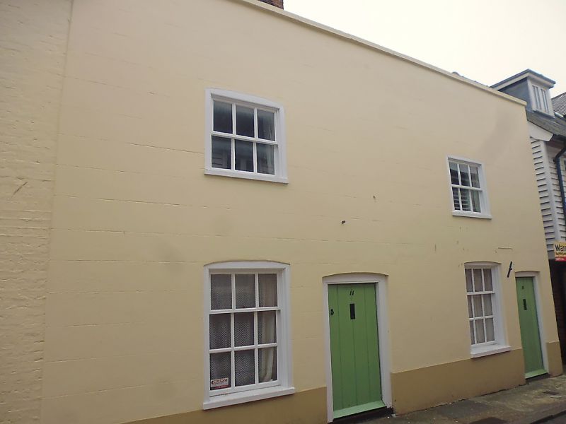
Entry Name: 14 and 15, Hawks Lane
Listing Date: 3 February 1970
Grade: II
Source: Historic England
Source ID: 1260903
English Heritage Legacy ID: 170636
ID on this website: 101260903
Location: Canterbury, Kent, CT1
County: Kent
District: Canterbury
Electoral Ward/Division: Westgate
Parish: Non Civil Parish
Built-Up Area: Canterbury
Traditional County: Kent
Lieutenancy Area (Ceremonial County): Kent
Tagged with: Building
1. 944 HAWKS LANE (South West Side)
Nos 14 & 15 TR 1457 NE 4/402 3.2.70.
II GV
2. Early C18 or earlier refronted in late C18. L-shaped. 2 storeys stuccoed on main elevation. Tile-hung lst floor and painted brick ground floor and side elevation. Parapet with stone copingon facade with hipped tiled roof surmounted by brick stack behind, 1 cambered sash in moulded architrave to each number. Glazing bars intact. Simple recessed door with moulded architrave to No 14 only. Brace to No 15. Modern brick lean-to to No 15. These buildings have group value with Nos 2-12 and close the vista to Stour Street.
Nos 1, 2, extension to No 6 & Nos 6 to 15 (consec) form a group.
Listing NGR: TR1476157758
External links are from the relevant listing authority and, where applicable, Wikidata. Wikidata IDs may be related buildings as well as this specific building. If you want to add or update a link, you will need to do so by editing the Wikidata entry.


Other nearby listed buildings