Approximate Location Map
Large Map »
Latitude: 51.3175 / 51°19'2"N
Longitude: 0.893 / 0°53'34"E
OS Eastings: 601696
OS Northings: 161572
OS Grid: TR016615
Mapcode National: GBR SW3.BLC
Mapcode Global: VHKJW.F4GV
Plus Code: 9F328V8V+X6
Entry Name: Brewery House, Fremlins Brewery
Listing Date: 9 July 1990
Grade: II
Source: Historic England
Source ID: 1260947
English Heritage Legacy ID: 438963
ID on this website: 101260947
Location: Faversham, Swale, Kent, ME13
County: Kent
District: Swale
Civil Parish: Faversham
Built-Up Area: Faversham
Traditional County: Kent
Lieutenancy Area (Ceremonial County): Kent
Tagged with: Brewery
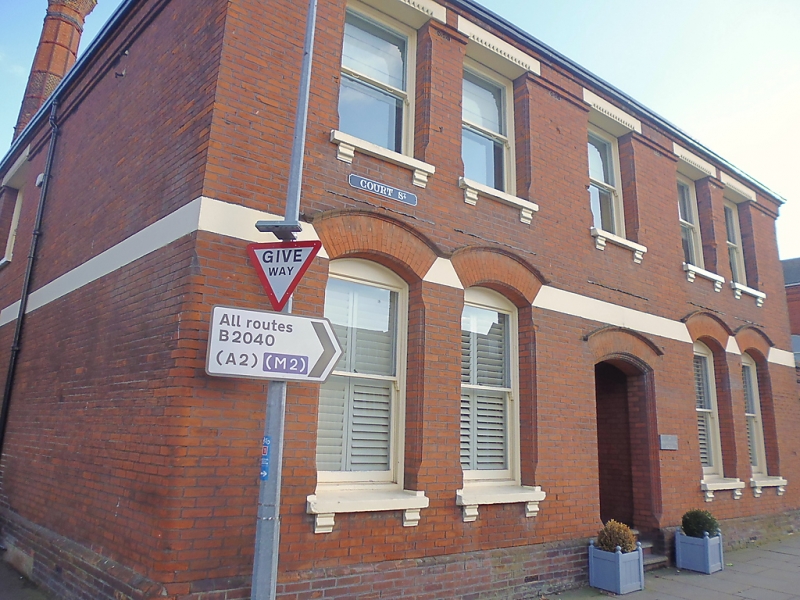
FAVERSHAM COURT STREET
TR 0161 NE
1/395 Brewery House, Fremlins
Brewery
GV II
Office building. c.1880. Red brick in stretcher bond. Hipped slate roof with
2 ribbed brick chimney-stacks. 2 storeys, 5 windows. Sashes without glazing
bars. Cambered sashes to ground floor. Cambered entrance with recessed door-
case with rectangular fanlight above. 3 steps to street. Footscraper and
plinth. Church Street elevation has 2 sashes, 1 tripartite.
Listing NGR: TR0169661572
External links are from the relevant listing authority and, where applicable, Wikidata. Wikidata IDs may be related buildings as well as this specific building. If you want to add or update a link, you will need to do so by editing the Wikidata entry.


Other nearby listed buildings
