Latitude: 51.4857 / 51°29'8"N
Longitude: -0.3098 / 0°18'35"W
OS Eastings: 517453
OS Northings: 177658
OS Grid: TQ174776
Mapcode National: GBR 74.4L6
Mapcode Global: VHGQW.LX2G
Plus Code: 9C3XFMPR+73
Entry Name: The Cedars
Listing Date: 11 July 1951
Grade: II
Source: Historic England
Source ID: 1261058
English Heritage Legacy ID: 438730
ID on this website: 101261058
Location: Brentford, Hounslow, London, TW8
County: London
District: Hounslow
Electoral Ward/Division: Syon
Parish: Non Civil Parish
Built-Up Area: Hounslow
Traditional County: Middlesex
Lieutenancy Area (Ceremonial County): Greater London
Church of England Parish: Brentford St Paul
Church of England Diocese: London
Tagged with: Architectural structure
1.
4419 THE UPPER BUTTS, BRENTFORD
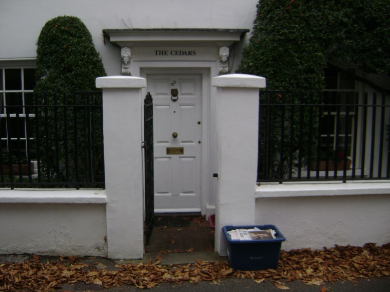
The Cedars
TQ 1777 NW 12/226 11.7.51.
II
2.
C18. Stucco. L plan, 2 storeys and attic, 3 double-hung sashes with sills.
Door surround of architrave, narrow side panels, carved consoles, cornice
hood. Modillion eaves cornice, modern red pantiles, 2 dormers. NMR.
Listing NGR: TQ1745377658
External links are from the relevant listing authority and, where applicable, Wikidata. Wikidata IDs may be related buildings as well as this specific building. If you want to add or update a link, you will need to do so by editing the Wikidata entry.


Other nearby listed buildings