Approximate Location Map
Large Map »
Latitude: 51.0063 / 51°0'22"N
Longitude: -2.1943 / 2°11'39"W
OS Eastings: 386466
OS Northings: 123005
OS Grid: ST864230
Mapcode National: GBR 1XH.XQ9
Mapcode Global: FRA 669G.6YR
Plus Code: 9C3V2R44+G7
Entry Name: St Martins
Listing Date: 15 October 1973
Grade: II
Source: Historic England
Source ID: 1261266
English Heritage Legacy ID: 438047
ID on this website: 101261266
Location: Shaftesbury, Dorset, SP7
County: Dorset
Civil Parish: Shaftesbury
Built-Up Area: Shaftesbury
Traditional County: Dorset
Lieutenancy Area (Ceremonial County): Dorset
Church of England Parish: Shaftesbury St Peter
Church of England Diocese: Salisbury
Tagged with: Architectural structure
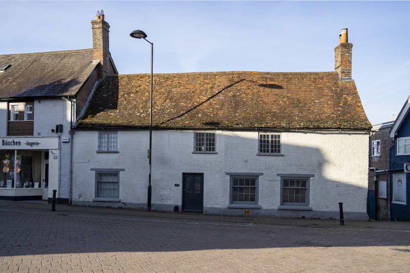
1.
1615 SALISBURY STREET
(South-blest Side)
St Martins.
ST 8623 1/102
II
2.
C18, 2-storey 4-bay painted brick cottage; sash windows below, casements
above. Hood to doorway. Plaintile roof with stone slates at eaves, 1
window above now blocked.
Listing NGR: ST8646623005
External links are from the relevant listing authority and, where applicable, Wikidata. Wikidata IDs may be related buildings as well as this specific building. If you want to add or update a link, you will need to do so by editing the Wikidata entry.


Other nearby listed buildings
