Approximate Location Map
Large Map »
Latitude: 51.0381 / 51°2'17"N
Longitude: -2.2772 / 2°16'37"W
OS Eastings: 380660
OS Northings: 126565
OS Grid: ST806265
Mapcode National: GBR 0VP.T9D
Mapcode Global: FRA 663C.QNH
Plus Code: 9C3V2PQF+64
Entry Name: Unidentified Table Tomb 7 Metres South of Chancel of St Mary's Church
Listing Date: 3 January 1985
Grade: II
Source: Historic England
Source ID: 1261331
English Heritage Legacy ID: 437823
ID on this website: 101261331
Location: St Mary's Church, Gillingham, Dorset, SP8
County: Dorset
Civil Parish: Gillingham
Built-Up Area: Gillingham
Traditional County: Dorset
Lieutenancy Area (Ceremonial County): Dorset
Church of England Parish: Gillingham St Mary the Virgin
Church of England Diocese: Salisbury
Tagged with: Architectural structure
ST 8026 GILLINGHAM HIGH STREET
(north side)
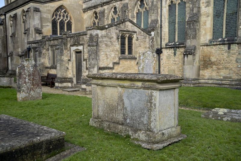
12/120 Unidentified Table-
Tomb 7m south of
chancel of St Mary's
Church
GV II
Table-tomb, probably late C18. Moulded top. Panelled sides with pilasters.
Blue lias panel. Inscription obliterated.
Listing NGR: ST8066026574
External links are from the relevant listing authority and, where applicable, Wikidata. Wikidata IDs may be related buildings as well as this specific building. If you want to add or update a link, you will need to do so by editing the Wikidata entry.


Other nearby listed buildings
