Approximate Location Map
Large Map »
Latitude: 51.2148 / 51°12'53"N
Longitude: 1.3579 / 1°21'28"E
OS Eastings: 634604
OS Northings: 151537
OS Grid: TR346515
Mapcode National: GBR X1W.N4C
Mapcode Global: VHLGZ.HQ6L
Plus Code: 9F336975+W4
Entry Name: The Old Rectory
Listing Date: 1 June 1949
Last Amended: 8 February 1974
Grade: II
Source: Historic England
Source ID: 1261552
English Heritage Legacy ID: 177234
ID on this website: 101261552
Location: Great Mongeham, Dover, Kent, CT14
County: Kent
District: Dover
Civil Parish: Great Mongeham
Built-Up Area: Deal
Traditional County: Kent
Lieutenancy Area (Ceremonial County): Kent
Tagged with: Clergy house
NORTHBOURNE ROAD
1.
1035
GREAT MONGEHAM
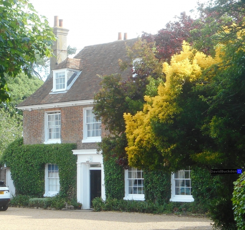
The Old Rectory
(Formerly listed under
Church Hill)
TR 35 SW 6/151 1.6.49.
II
2.
C18. 2 storeys and attics red brick. Hipped tiled roof with 3 dormers. Eaves
cornice with modillions. Brick stringcourse above ground floor. 3 sashes.
Doorcase with pilasters and entablature, 4 panel moulded door and thin rectangular
fanlight.
Listing NGR: TR3460451536
External links are from the relevant listing authority and, where applicable, Wikidata. Wikidata IDs may be related buildings as well as this specific building. If you want to add or update a link, you will need to do so by editing the Wikidata entry.


Other nearby listed buildings
