Latitude: 51.4196 / 51°25'10"N
Longitude: -1.7322 / 1°43'55"W
OS Eastings: 418718
OS Northings: 168983
OS Grid: SU187689
Mapcode National: GBR 4X2.T27
Mapcode Global: VHB46.XLM4
Plus Code: 9C3WC799+R4
Entry Name: 30, High Street
Listing Date: 21 October 1974
Grade: II
Source: Historic England
Source ID: 1261854
English Heritage Legacy ID: 310332
ID on this website: 101261854
Location: Marlborough, Wiltshire, SN8
County: Wiltshire
Civil Parish: Marlborough
Built-Up Area: Marlborough
Traditional County: Wiltshire
Lieutenancy Area (Ceremonial County): Wiltshire
Tagged with: Building
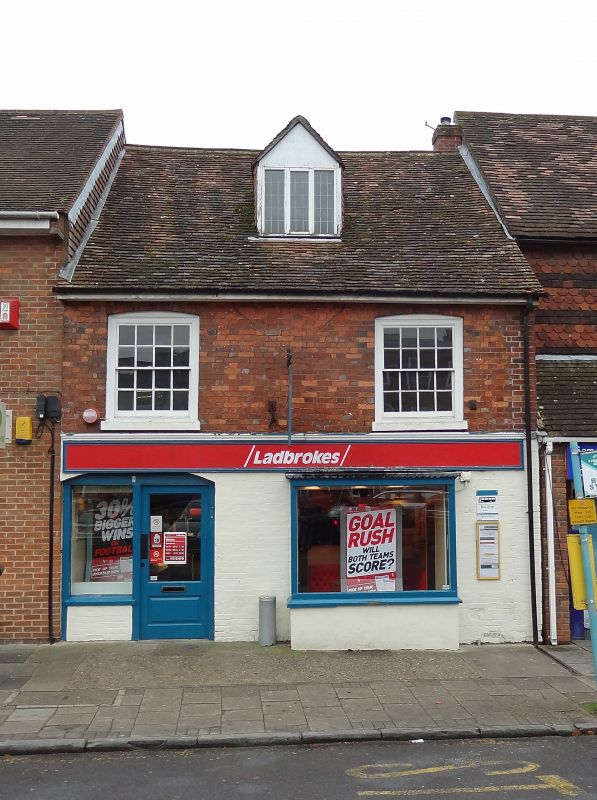
HIGH STREET
1.
5407
(South Side)
No 30
SU 1868 2/177
II GV
2.
C18. Red brick. Pitched old tile roof, with overhanging eaves. 2 storeys and
attics. Ground floor has 1 modern shop front, and 1 oblong C19 bay shop front.
lst floor has 2 cased sashes with glazing bars. I attic dormer with pitched
roof, tile-hung cheeks, and casements with lead glazing bars.
Nos 30 to 38 (consec) form a group.
Listing NGR: SU1871868983
External links are from the relevant listing authority and, where applicable, Wikidata. Wikidata IDs may be related buildings as well as this specific building. If you want to add or update a link, you will need to do so by editing the Wikidata entry.


Other nearby listed buildings