Latitude: 53.3009 / 53°18'3"N
Longitude: -2.7067 / 2°42'24"W
OS Eastings: 352996
OS Northings: 378452
OS Grid: SJ529784
Mapcode National: GBR 9ZJ8.SF
Mapcode Global: WH87Y.D998
Plus Code: 9C5V872V+98
Entry Name: Frodsham Bridge
Listing Date: 6 December 1985
Grade: II
Source: Historic England
Source ID: 1261905
English Heritage Legacy ID: 436335
ID on this website: 101261905
Location: Newtown, Cheshire West and Chester, Cheshire, WA6
County: Cheshire West and Chester
Civil Parish: Frodsham
Built-Up Area: Frodsham
Traditional County: Cheshire
Lieutenancy Area (Ceremonial County): Cheshire
Church of England Parish: Aston St Peter
Church of England Diocese: Chester
Tagged with: Bridge
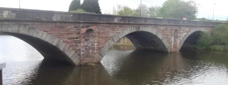
BRIDGE LANE, FRODSHAM AND SJ 57 NW FRODSHAM C.P. SUTTON CAUSEWAY 2/56 Frodsham Bridge. II Part in Sutton C.P. Road bridge over River Weaver, 1850, of red sandstone and limestone. 3 deep segmental arches each circa 25 metres span. Limestone voussoirs with chamfered rock-faced rustication; plain parapets of smooth-finished limestone blocks; all other parts of tooled sandstone with chamfered rustication. Slightly projecting rectangular piers have round-arched niches. Battered abutments. Raised keystone on each face of central arch inscribed 1850. SJ57 NW SUTTON CP SUTTON CAUSEWAY AND BRIDGE LANE FRODSHAM Frodsham Bridge II See under Bridge Lane,Frodsham.
Listing NGR: SJ5299678451
External links are from the relevant listing authority and, where applicable, Wikidata. Wikidata IDs may be related buildings as well as this specific building. If you want to add or update a link, you will need to do so by editing the Wikidata entry.


Other nearby listed buildings