Approximate Location Map
Large Map »
Latitude: 50.9504 / 50°57'1"N
Longitude: 0.7324 / 0°43'56"E
OS Eastings: 592024
OS Northings: 120329
OS Grid: TQ920203
Mapcode National: GBR RZ1.60T
Mapcode Global: FRA D6FL.M5L
Plus Code: 9F22XP2J+5X
Entry Name: Cobbled Street
Listing Date: 11 September 1972
Grade: II
Source: Historic England
Source ID: 1262438
English Heritage Legacy ID: 435053
ID on this website: 101262438
Location: Rye, Rother, East Sussex, TN31
County: East Sussex
District: Rother
Civil Parish: Rye
Built-Up Area: Rye
Traditional County: Sussex
Lieutenancy Area (Ceremonial County): East Sussex
Church of England Parish: Rye
Church of England Diocese: Chichester
Tagged with: Street Architectural structure
1.
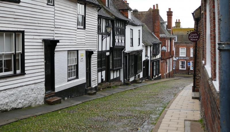
1578 WEST STREET
Cobbled Street
TQ 9220 1/264
II
2.
Cobbled Street.
Listing NGR: TQ9201320354
External links are from the relevant listing authority and, where applicable, Wikidata. Wikidata IDs may be related buildings as well as this specific building. If you want to add or update a link, you will need to do so by editing the Wikidata entry.


Other nearby listed buildings
