Latitude: 51.2277 / 51°13'39"N
Longitude: 1.4036 / 1°24'12"E
OS Eastings: 637731
OS Northings: 153112
OS Grid: TR377531
Mapcode National: GBR X1R.TZR
Mapcode Global: VHMDG.8DWQ
Plus Code: 9F336CH3+3C
Entry Name: Red Roofs
Listing Date: 8 February 1974
Grade: II
Source: Historic England
Source ID: 1262441
English Heritage Legacy ID: 177085
ID on this website: 101262441
Location: Deal, Dover, Kent, CT14
County: Kent
District: Dover
Civil Parish: Deal
Built-Up Area: Deal
Traditional County: Kent
Lieutenancy Area (Ceremonial County): Kent
Tagged with: Architectural structure
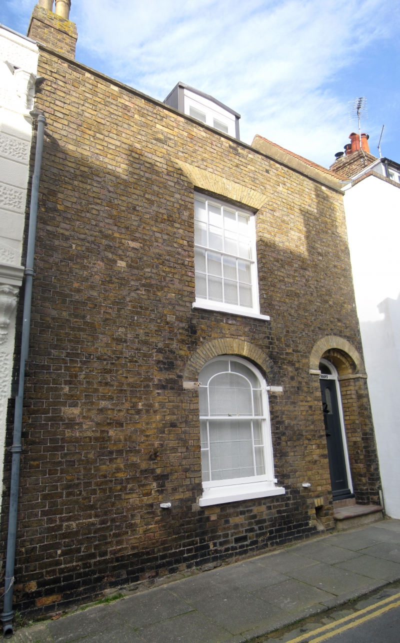
GOLDEN STREET
1.
1035
(North Side)
No 2
(Red Roofs)
TR 3753 SE 2/271
II GV
2.
Mid C19. 2 storeys basement and attics yellow brick. Parapet with stone coping.
sedimented dormer. 1 sash with glazing bars intact on upper floor, round-headed
window on ground floor. Round-headed doorcase. Included for group value only.
Nos 1 to 6 (consec) form a group.
Listing NGR: TR3773153112
External links are from the relevant listing authority and, where applicable, Wikidata. Wikidata IDs may be related buildings as well as this specific building. If you want to add or update a link, you will need to do so by editing the Wikidata entry.


Other nearby listed buildings