Latitude: 53.1678 / 53°10'3"N
Longitude: -1.1895 / 1°11'22"W
OS Eastings: 454280
OS Northings: 363710
OS Grid: SK542637
Mapcode National: GBR 8F0.D3D
Mapcode Global: WHDFS.PMSW
Plus Code: 9C5W5R96+46
Entry Name: Numbers 82 to 92 and Adjoining Boundary Wall
Listing Date: 4 April 1974
Grade: II
Source: Historic England
Source ID: 1262567
English Heritage Legacy ID: 434653
ID on this website: 101262567
Location: Mansfield Woodhouse, Mansfield, Nottinghamshire, NG19
County: Nottinghamshire
District: Mansfield
Electoral Ward/Division: Park Hall
Parish: Non Civil Parish
Built-Up Area: Mansfield Woodhouse
Traditional County: Nottinghamshire
Lieutenancy Area (Ceremonial County): Nottinghamshire
Church of England Parish: Mansfield Woodhouse
Church of England Diocese: Southwell and Nottingham
Tagged with: Building
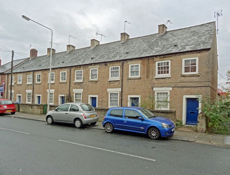
MANSFIELD WOODHOUSE ALBERT STREET SK 5463 NW (east side) 5/18 Nos. 82 to 92 (even) and adjoining 4.4.74 boundary wall G.V. II Row of six artisans' cottages. Early C19. Dressed stone with slate roof. 5 ridge and single gable stacks. 2 storeys, 12 bays. Windows are C20 casements. Doors have plain stone architraves. West front has 6 similar facades, each with casement to left and door to right. Above, 12 casements. South gable has to right, a small casement. Adjoining dressed stone boundary wall has gabled stone coping. Approx. 50 M long.
Listing NGR: SK5428063710
External links are from the relevant listing authority and, where applicable, Wikidata. Wikidata IDs may be related buildings as well as this specific building. If you want to add or update a link, you will need to do so by editing the Wikidata entry.


Other nearby listed buildings