Latitude: 51.3089 / 51°18'32"N
Longitude: 0.9619 / 0°57'42"E
OS Eastings: 606535
OS Northings: 160808
OS Grid: TR065608
Mapcode National: GBR SW6.XP6
Mapcode Global: VHKJX.MCDG
Plus Code: 9F328X56+HQ
Entry Name: K6 Telephone Kiosk
Listing Date: 8 October 1989
Grade: II
Source: Historic England
Source ID: 1262904
English Heritage Legacy ID: 176797
ID on this website: 101262904
Location: Hernhill, Swale, Kent, ME13
County: Kent
District: Swale
Civil Parish: Hernhill
Traditional County: Kent
Lieutenancy Area (Ceremonial County): Kent
Tagged with: K6 telephone box
This list entry was subject to a Minor Amendment on 18/03/2014
TR 06 SE
3/152
HERNHILL
STAPLE STREET
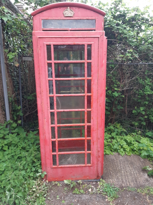
K6 Telephone Kiosk
GV
II
Telephone kiosk. Type K6. Designed 1935 by Sir Giles Gilbert Scott. Made by various contractors. Cast iron.
Square kiosk with domed roof. Unperforated George VI crowns to top panels and margin glazing to windows and door.
Listing NGR: TQ9872863855
External links are from the relevant listing authority and, where applicable, Wikidata. Wikidata IDs may be related buildings as well as this specific building. If you want to add or update a link, you will need to do so by editing the Wikidata entry.


Other nearby listed buildings