Latitude: 50.8135 / 50°48'48"N
Longitude: -0.3678 / 0°22'4"W
OS Eastings: 515082
OS Northings: 102821
OS Grid: TQ150028
Mapcode National: GBR HMH.XGZ
Mapcode Global: FRA B63Y.BJ5
Plus Code: 9C2XRJ7J+CV
Entry Name: 42, High Street
Listing Date: 21 May 1976
Grade: II
Source: Historic England
Source ID: 1263332
English Heritage Legacy ID: 432603
ID on this website: 101263332
Location: Worthing, West Sussex, BN11
County: West Sussex
District: Worthing
Electoral Ward/Division: Central
Parish: Non Civil Parish
Built-Up Area: Worthing
Traditional County: Sussex
Lieutenancy Area (Ceremonial County): West Sussex
Church of England Parish: Worthing St George
Church of England Diocese: Chichester
Tagged with: Building
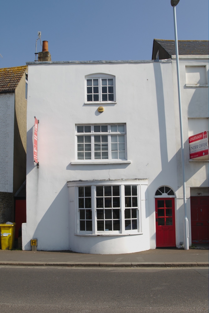
HIGH STREET
1.
5406 (East Side)
No 42
TQ 1502 NW 5/131
II GV
2.
Probably mid C19. 3 storeys. Stucco-fronted. Slate roof. One window (casements
on 1st and 2nd floors, the former wider, and a sash bow window on the ground floor).
Nos 40 to 44 (even) including No 40A form a group.
Listing NGR: TQ1508202821
External links are from the relevant listing authority and, where applicable, Wikidata. Wikidata IDs may be related buildings as well as this specific building. If you want to add or update a link, you will need to do so by editing the Wikidata entry.


Other nearby listed buildings