Approximate Location Map
Large Map »
Latitude: 51.3554 / 51°21'19"N
Longitude: -1.9942 / 1°59'39"W
OS Eastings: 400501
OS Northings: 161813
OS Grid: SU005618
Mapcode National: GBR 2TV.SS9
Mapcode Global: VHB4G.D639
Plus Code: 9C3W9244+58
Entry Name: Wharf Bridge
Listing Date: 9 April 1954
Grade: II
Source: Historic England
Source ID: 1263776
English Heritage Legacy ID: 431454
ID on this website: 101263776
Location: Devizes, Wiltshire, SN10
County: Wiltshire
Civil Parish: Devizes
Built-Up Area: Devizes
Traditional County: Wiltshire
Lieutenancy Area (Ceremonial County): Wiltshire
Tagged with: Bridge
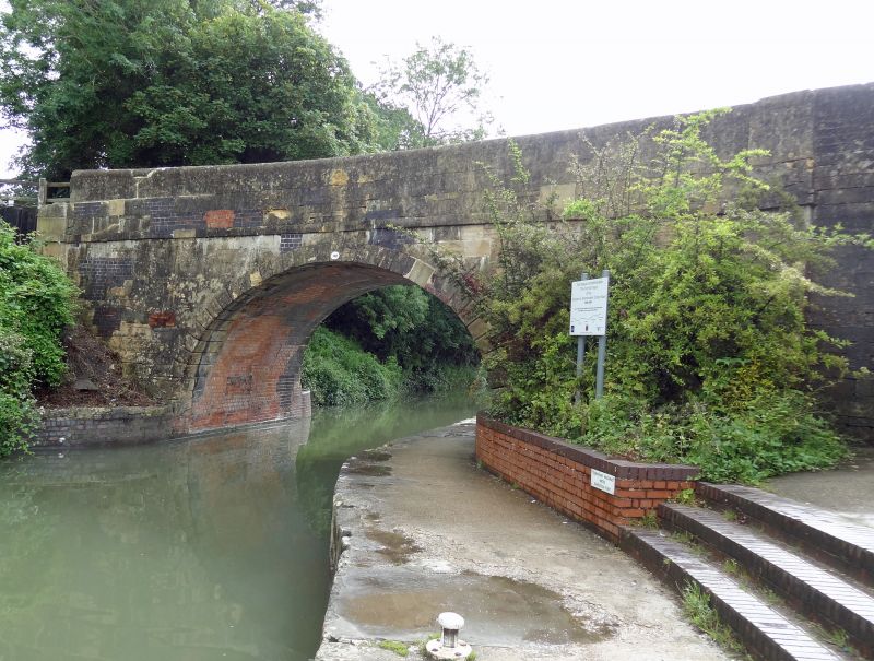
1. Wharf Bridge
1042
SU 0061 3a/216B 9.4.54.
II
2.
One of 3 other bridges over the canal, all of same design. Large stilted
arch of stone, with radiating chamfered voussoirs and central keystone,
the chamfered joints carried horizontally through the archway. Projecting
string at road level and solid stone parapet with weathered coping. The
design is utlitarian of its day and without pretence of architectural quality;
well built however and with effective simple treatment of stonework.
Listing NGR: SU0050161813
External links are from the relevant listing authority and, where applicable, Wikidata. Wikidata IDs may be related buildings as well as this specific building. If you want to add or update a link, you will need to do so by editing the Wikidata entry.


Other nearby listed buildings
