Approximate Location Map
Large Map »
Latitude: 51.8216 / 51°49'17"N
Longitude: -2.2979 / 2°17'52"W
OS Eastings: 379563
OS Northings: 213711
OS Grid: SO795137
Mapcode National: GBR 0K5.MW8
Mapcode Global: VH94J.4G1W
Plus Code: 9C3VRPC2+MR
Entry Name: Milepost at National Grid Reference So 796 137
Listing Date: 30 November 1989
Grade: II
Source: Historic England
Source ID: 1263888
English Heritage Legacy ID: 352203
ID on this website: 101263888
Location: Stroud, Gloucestershire, GL2
County: Gloucestershire
District: Stroud
Civil Parish: Hardwicke
Built-Up Area: Gloucester
Traditional County: Gloucestershire
Lieutenancy Area (Ceremonial County): Gloucestershire
Church of England Parish: Hardwicke
Church of England Diocese: Gloucester
Tagged with: Milestone
SO 71 SE HARDWICKE GLOUCESTER AND
SHARPNESS CANAL
4/161
Milepost at NGR
SO 796 137
- II
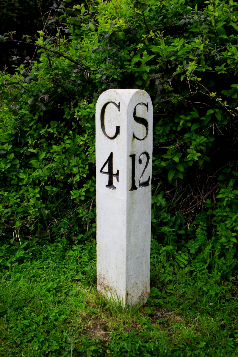
Canal milepost. c1827. Painted, triangular stone post with rounded top.
Incised serif lettering and numbers: on left face, G4; on right face, S12.
Listing NGR: SO7956313710
External links are from the relevant listing authority and, where applicable, Wikidata. Wikidata IDs may be related buildings as well as this specific building. If you want to add or update a link, you will need to do so by editing the Wikidata entry.


Other nearby listed buildings
