Approximate Location Map
Large Map »
Latitude: 50.4309 / 50°25'51"N
Longitude: -3.684 / 3°41'2"W
OS Eastings: 280492
OS Northings: 60357
OS Grid: SX804603
Mapcode National: GBR QM.T78B
Mapcode Global: FRA 375X.8ML
Plus Code: 9C2RC8J8+9C
Entry Name: 18, Fore Street
Listing Date: 25 March 1969
Grade: II
Source: Historic England
Source ID: 1264913
English Heritage Legacy ID: 426517
ID on this website: 101264913
Location: Totnes, South Hams, Devon, TQ9
County: Devon
District: South Hams
Civil Parish: Totnes
Built-Up Area: Totnes
Traditional County: Devon
Lieutenancy Area (Ceremonial County): Devon
Church of England Parish: Totnes St Mary
Church of England Diocese: Exeter
Tagged with: Building
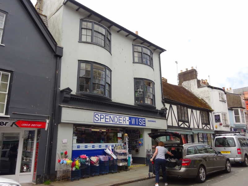
1.
5180 FORE STREET
(South Side)
------------
No 18
SX 8060 SW 2/24A 25.3.69.
II GV
2.
Late C18 front. 3 storeys. Welsh slate roof with bracketed projecting eaves and
moulded stacks. Rendered front. Two 3-light bow windows rise through 1st and 2nd
floors, with sashes and glazing bars. Modern ground floor shopfront with C19 fascia
above flanked by brackets, and with dentil cornice.
Listing NGR: SX8049260357
External links are from the relevant listing authority and, where applicable, Wikidata. Wikidata IDs may be related buildings as well as this specific building. If you want to add or update a link, you will need to do so by editing the Wikidata entry.


Other nearby listed buildings
