Latitude: 52.0594 / 52°3'33"N
Longitude: 1.1582 / 1°9'29"E
OS Eastings: 616599
OS Northings: 244815
OS Grid: TM165448
Mapcode National: GBR TMP.ZK7
Mapcode Global: VHLBT.1H4N
Plus Code: 9F433555+P7
Entry Name: Brick Wall to St Margaret's Churchyard
Listing Date: 19 December 1951
Last Amended: 4 August 1972
Grade: II
Source: Historic England
Source ID: 1265014
English Heritage Legacy ID: 426377
ID on this website: 101265014
Location: Ipswich, Suffolk, IP4
County: Suffolk
District: Ipswich
Electoral Ward/Division: St Margaret's
Parish: Non Civil Parish
Built-Up Area: Ipswich
Traditional County: Suffolk
Lieutenancy Area (Ceremonial County): Suffolk
Church of England Parish: Ipswich St Margaret
Church of England Diocese: St.Edmundsbury and Ipswich
Tagged with: Wall
1. 1260 SOANE STREET (North Side)
Brick Wall to St Margaret's Churchyard (formerly listed as Brick Wall to Christchurch Mansion Park) TM 1644 NE 2/208 19.12.51.
II GV
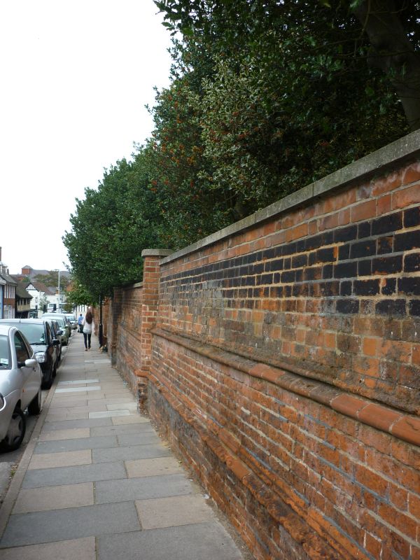
2. A C16 red brick wall extending east from the entrance to Christchurch Park for approximately 150 ft to the C20 entrance way into St Margaret's Churchyard It has 2 moulded brick string courses and is broken at intervals of about 24 ft by octagonal piers. Oone bay of about 12 ft at the west end is about 12 ft high with a moulded stone coping and a moulded stone cap and finial to the pier. The remainder of the wall is about 6-8 ft high with a C20 precast coping. Some 27 ft at the east end has only the base of the wall remaining.
Nos 2 to 8 (even), No 1 (Lodge to Christchurch Mansion), Entrance Wall and Gates to Christchurch Park and Brick Wall to St Margaret's Churchyard form a group with Nos 56 and 58 (Cafe Blanchfleur), St Margaret's Street.
Listing NGR: TM1659944815
External links are from the relevant listing authority and, where applicable, Wikidata. Wikidata IDs may be related buildings as well as this specific building. If you want to add or update a link, you will need to do so by editing the Wikidata entry.


Other nearby listed buildings