Latitude: 51.0356 / 51°2'8"N
Longitude: -2.8194 / 2°49'9"W
OS Eastings: 342640
OS Northings: 126564
OS Grid: ST426265
Mapcode National: GBR MF.H1HM
Mapcode Global: FRA 46ZC.WZG
Plus Code: 9C3V25PJ+66
Entry Name: Huish Farm House
Listing Date: 17 April 1959
Grade: II
Source: Historic England
Source ID: 1265068
English Heritage Legacy ID: 263128
ID on this website: 101265068
Location: Huish Episcopi, Somerset, TA10
County: Somerset
District: South Somerset
Civil Parish: Huish Episcopi
Built-Up Area: Langport
Traditional County: Somerset
Lieutenancy Area (Ceremonial County): Somerset
Tagged with: Farmhouse
HUISH EPISCOPI CP - ST4226 11/63 Huish Farm House 17.4.59
GV II
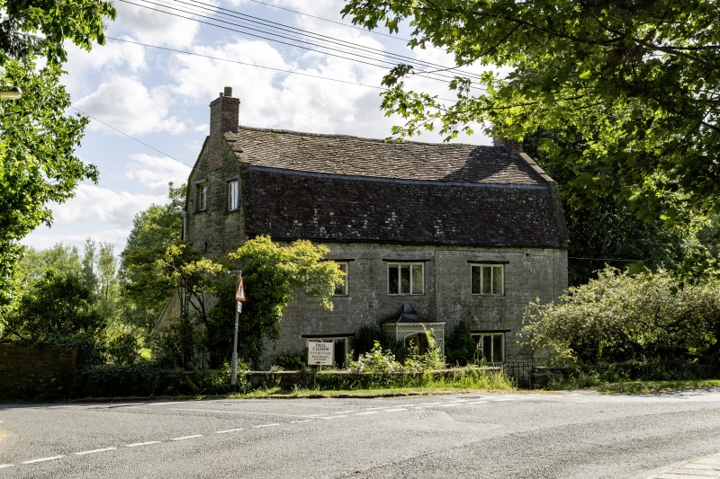
Detached house. Probably early C19. Local lias stone cut and squared; plain clay tile Mansard roof between stepped coped gables; brick end chimney stacks. Two storeys with attics, 3 bays. Three-light plain casement windows under timber lintols; to lower bay 2 a 6-panel door with glazed toplights, set in wide timber lattice porch with lead covered bell hip roof; modern casements to attic gables. Interior not seen.
Listing NGR: ST4265326546
External links are from the relevant listing authority and, where applicable, Wikidata. Wikidata IDs may be related buildings as well as this specific building. If you want to add or update a link, you will need to do so by editing the Wikidata entry.


Other nearby listed buildings