Approximate Location Map
Large Map »
Latitude: 50.9759 / 50°58'33"N
Longitude: -2.7142 / 2°42'51"W
OS Eastings: 349952
OS Northings: 119857
OS Grid: ST499198
Mapcode National: GBR MK.LXWB
Mapcode Global: FRA 566J.ND4
Plus Code: 9C2VX7GP+98
Entry Name: Walters Farmhouse and Front Boundary Wall
Listing Date: 19 April 1961
Grade: II
Source: Historic England
Source ID: 1265104
English Heritage Legacy ID: 425796
ID on this website: 101265104
Location: Tintinhull, Somerset, BA22
County: Somerset
District: South Somerset
Civil Parish: Tintinhull
Built-Up Area: Tintinhull
Traditional County: Somerset
Lieutenancy Area (Ceremonial County): Somerset
Tagged with: Farmhouse
No. 6 etc, Queen Street.
13/365
6/365
----------------------------------------------------------------------------------------
No. 6 etc, Queen Street.
13/365
6/365
--------------------------------------------------------------------------------------
TINTINHULL CP QUEEN STREET (East side)
ST4919
13/365 No. 6
(Walters Farmhouse); and front
boundary wall
19.4.61
GV II
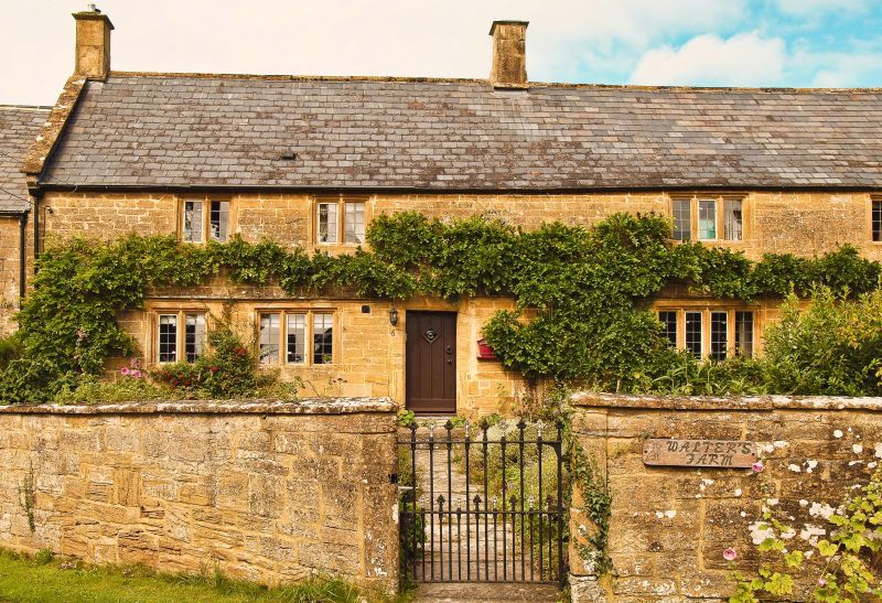
Detached farmhouse. C17, with additions. Ham stone, mostly ashlar; Welsh slate roof between coped gables; stone slab
chimney stacks. Two storeys, 4-bays. Hollow-chamfer mullioned windows of 2, 2, 3 and 3 lights above and 2, 3, 4 and 4
lights below, the lower windows paired under common labels: right of bay 2 a C20 door in reconstructed stone porch with
shallow hipped metal roof. Attached to west gable a later 2-storey building with hipped slate roof, with the west end
wall angled to fit the roadside boundary: 3-light casement to first floor, on south side, and on west angle a boarded
door in plain opening, up one step, above which is a semi-circular-arched sash window, now partly covered; in north
wall two segmental-arched 12-pane sash windows - the whole suggesting a meeting room. Interiors not seen. Adjoining
this extension, and marking the southern boundary as far as the south-east corner of No 4 (q.v), a wall about 2 metres
high, in Ham stone cut and squared, with thin coping, with a small cast-iron gate with fleurs-de-lys finials opposite
the door, adding to the setting of the house and to the streetscene.
Listing NGR: ST4995219857
External links are from the relevant listing authority and, where applicable, Wikidata. Wikidata IDs may be related buildings as well as this specific building. If you want to add or update a link, you will need to do so by editing the Wikidata entry.


Other nearby listed buildings
