Latitude: 51.555 / 51°33'18"N
Longitude: -0.0831 / 0°4'59"W
OS Eastings: 532994
OS Northings: 185754
OS Grid: TQ329857
Mapcode National: GBR HC.MQN
Mapcode Global: VHGQT.H5YS
Plus Code: 9C3XHW48+2Q
Entry Name: 66, Milton Grove N16
Listing Date: 4 February 1975
Grade: II
Source: Historic England
Source ID: 1265592
English Heritage Legacy ID: 424488
ID on this website: 101265592
Location: Stoke Newington, Hackney, London, N16
County: London
District: Hackney
Electoral Ward/Division: Clissold
Parish: Non Civil Parish
Built-Up Area: Hackney
Traditional County: Middlesex
Lieutenancy Area (Ceremonial County): Greater London
Church of England Parish: St Matthias Stoke Newington
Church of England Diocese: London
Tagged with: Building
MILTON GROVE N16 1. 5013 (West Side) ---------------- No 66 TQ 3285 17/388 TQ 3385 18/388 II
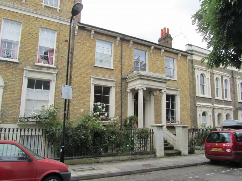
2. Mid C19 villa of 2 storeys and basement, 3 windows. Stock brick. Fairly low pitched hipped slated roof has eaves soffit with long paired brackets. Gauged near-flat brick arches to lat floor windows in stucco-lined reveals. Ground floor windows in panelled stucco surrounds with console bracketed cornices and projecting bracketed cills with ornamental cast iron guards. 4-paned sash windows. 7 steps to prostyle Ionic porch with dentil cornice and round-arched entrance in moulded architrave with impost blocks. 4-panel half-glazed door with side lights and wide fanlight. Lotus-headed area railings.
Listing NGR: TQ3299485754
External links are from the relevant listing authority and, where applicable, Wikidata. Wikidata IDs may be related buildings as well as this specific building. If you want to add or update a link, you will need to do so by editing the Wikidata entry.


Other nearby listed buildings