Latitude: 51.5465 / 51°32'47"N
Longitude: -0.07 / 0°4'12"W
OS Eastings: 533922
OS Northings: 184827
OS Grid: TQ339848
Mapcode National: GBR HD.C0B
Mapcode Global: VHGQT.QDVB
Plus Code: 9C3XGWWH+HX
Entry Name: St Bartholomew's Vicarage
Listing Date: 17 December 1974
Grade: II
Source: Historic England
Source ID: 1265785
English Heritage Legacy ID: 423714
ID on this website: 101265785
Location: Dalston, Hackney, London, E8
County: London
District: Hackney
Electoral Ward/Division: Dalston
Parish: Non Civil Parish
Built-Up Area: Hackney
Traditional County: Middlesex
Lieutenancy Area (Ceremonial County): Greater London
Church of England Parish: St Mark Dalston
Church of England Diocese: London
Tagged with: Clergy house
1. DALSTON LANE E8 5013 (North Side) --------------- St Bartholomew's Vicarage TQ 3384 24/155 17.12.74 II
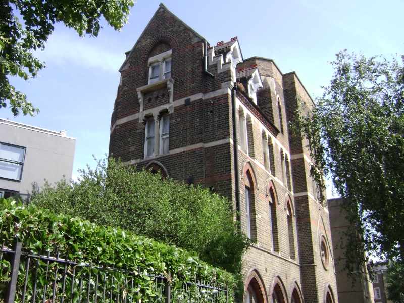
2. Interestingly varied Gothic building of the 3rd quarter of C19, once integral with its church (now demolished), the link shown by a free-standing granite column at north corner supporting part of an arch which now leads nowhere. 4 storeys, 4 bays in front, the right bay wider and projecting slightly. Parapet at right, steeply pitched slated roof at left with 2 gabled dormers. Left return under a large, stone coped gable. Stock brick with bands and dressings of red brick and stone. Window treatment varying from floor to floor. Top windows are cusped lancets, 2nd floor grouped lights with shouldered lintels and colonette mullions. On 1st floor large plain windows under pointed relieving arches with hoodmoulds except in right bay where a cusped round window sits above pointed arched doorway. Ground floor pointed arcade with recessed brick panels holding lancets. Empty and dilapidated at time of survey.
Listing NGR: TQ3392284827
External links are from the relevant listing authority and, where applicable, Wikidata. Wikidata IDs may be related buildings as well as this specific building. If you want to add or update a link, you will need to do so by editing the Wikidata entry.


Other nearby listed buildings