Approximate Location Map
Large Map »
Latitude: 50.9841 / 50°59'2"N
Longitude: -0.6115 / 0°36'41"W
OS Eastings: 497563
OS Northings: 121438
OS Grid: SU975214
Mapcode National: GBR FGL.86S
Mapcode Global: FRA 96LH.ZKS
Plus Code: 9C2XX9MQ+JC
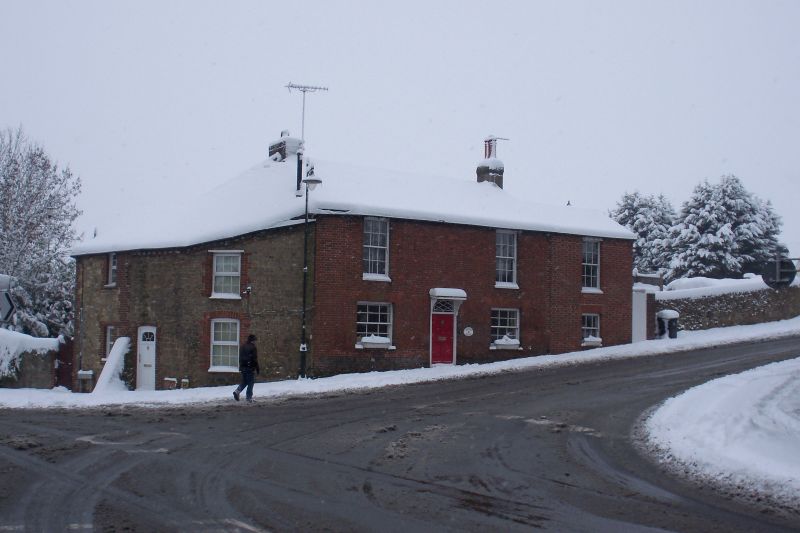
Entry Name: Pound House
Listing Date: 22 May 1985
Grade: II
Source: Historic England
Source ID: 1266263
English Heritage Legacy ID: 422033
ID on this website: 101266263
Location: Petworth, Chichester, West Sussex, GU28
County: West Sussex
District: Chichester
Civil Parish: Petworth
Built-Up Area: Petworth
Traditional County: Sussex
Lieutenancy Area (Ceremonial County): West Sussex
Church of England Parish: Petworth St Mary
Church of England Diocese: Chichester
Tagged with: House
SU 9721 PETWORTH MIDHURST ROAD
29/330 Pound House
II
House. Early C19. Two storeys. Two windows. Red brick. Tiled roof. Glazing bars
intact. Doorway with flat hood on brackets and rectangular fanlight.
Listing NGR: SU9756321438
External links are from the relevant listing authority and, where applicable, Wikidata. Wikidata IDs may be related buildings as well as this specific building. If you want to add or update a link, you will need to do so by editing the Wikidata entry.


Other nearby listed buildings
