Approximate Location Map
Large Map »
Latitude: 50.9852 / 50°59'6"N
Longitude: -0.6075 / 0°36'26"W
OS Eastings: 497840
OS Northings: 121569
OS Grid: SU978215
Mapcode National: GBR FGL.37G
Mapcode Global: FRA 96MH.TBT
Plus Code: 9C2XX9PV+32
Entry Name: Stone House
Listing Date: 22 February 1955
Grade: II
Source: Historic England
Source ID: 1266426
English Heritage Legacy ID: 421593
ID on this website: 101266426
Location: Petworth, Chichester, West Sussex, GU28
County: West Sussex
District: Chichester
Civil Parish: Petworth
Built-Up Area: Petworth
Traditional County: Sussex
Lieutenancy Area (Ceremonial County): West Sussex
Church of England Parish: Petworth St Mary
Church of England Diocese: Chichester
Tagged with: House
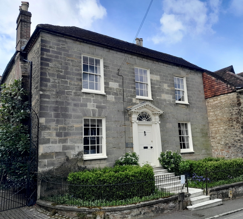
SU 9721 PETWORTH HIGH STREET
(south side)
29/292 Stone House
22.2.55
II
House. C18. Two storeys. Three windows. Ashlar. Hipped tiled roof. Glazing bars
missing. Doorway up eight steps with fluted Ionic pilasters, pediment, semi-circular
fanlight and door of six fielded panels.
Listing NGR: SU9784021569
External links are from the relevant listing authority and, where applicable, Wikidata. Wikidata IDs may be related buildings as well as this specific building. If you want to add or update a link, you will need to do so by editing the Wikidata entry.


Other nearby listed buildings
