Approximate Location Map
Large Map »
Latitude: 51.3582 / 51°21'29"N
Longitude: 1.4264 / 1°25'35"E
OS Eastings: 638647
OS Northings: 167694
OS Grid: TR386676
Mapcode National: GBR X07.TQ0
Mapcode Global: VHMCW.N4Y5
Plus Code: 9F339C5G+7H
Entry Name: The Oast House
Listing Date: 20 September 1974
Grade: II
Source: Historic England
Source ID: 1267463
English Heritage Legacy ID: 418611
ID on this website: 101267463
Location: Upton, Thanet, Kent, CT10
County: Kent
District: Thanet
Civil Parish: Broadstairs and St. Peters
Built-Up Area: Broadstairs
Traditional County: Kent
Lieutenancy Area (Ceremonial County): Kent
Tagged with: House
VALE ROAD
1.
5283
(South Side)
UPTON
The Oast House
TR 36 NE 5/180
II
2.
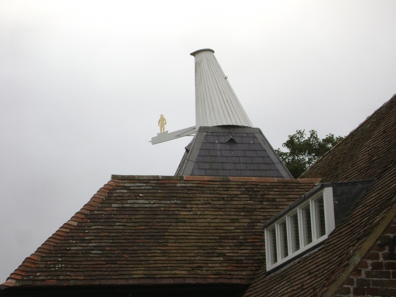
Probably C18. Partly inhabited and partly used as a stable. Timber-framed barn
of 1 storey. Tiled roof flint-faced with flint and brick end gable and 1/2 hipped
gable to right hand side. The left hand side has a mid C19 cast with slate pyramidal
cap. Hipped tiled pentice to barn. Rear elevation to barn is of flint with 3
casements, 1 of which is pointed with Gothick glazing.
Listing NGR: TR3864767694
External links are from the relevant listing authority and, where applicable, Wikidata. Wikidata IDs may be related buildings as well as this specific building. If you want to add or update a link, you will need to do so by editing the Wikidata entry.


Other nearby listed buildings
