Approximate Location Map
Large Map »
Latitude: 51.4042 / 51°24'15"N
Longitude: 0.1971 / 0°11'49"E
OS Eastings: 552919
OS Northings: 169533
OS Grid: TQ529695
Mapcode National: GBR TR.6CJ
Mapcode Global: VHHP0.CYKX
Plus Code: 9F32C53W+MR
Entry Name: Stables to East of the Old Place
Listing Date: 22 October 1982
Grade: II
Source: Historic England
Source ID: 1267475
English Heritage Legacy ID: 418635
ID on this website: 101267475
Location: Swanley Village, Sevenoaks, Kent, BR8
County: Kent
District: Sevenoaks
Civil Parish: Swanley
Built-Up Area: Swanley
Traditional County: Kent
Lieutenancy Area (Ceremonial County): Kent
Church of England Parish: Swanley St Paul
Church of England Diocese: Rochester
Tagged with: Stable
1.
5280
TQ 5269
8/228
SWANLEY
SWANLEY VILLAGE ROAD
(south side)
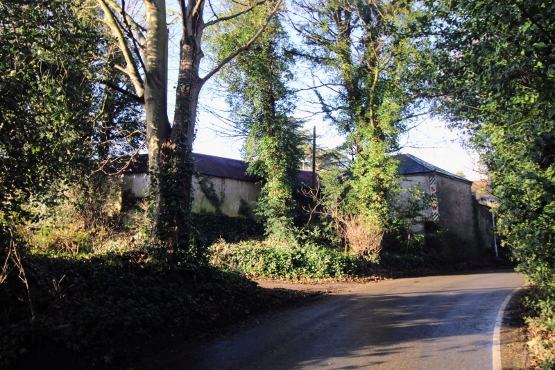
Stables to east of The Old Place
II
GV
2.
Circa 1830. One storey buff brick. Roof now covered with corrugated iron. Included
for group value showing a complete early C19 small residence.
Listing NGR: TQ5291969533
External links are from the relevant listing authority and, where applicable, Wikidata. Wikidata IDs may be related buildings as well as this specific building. If you want to add or update a link, you will need to do so by editing the Wikidata entry.


Other nearby listed buildings
