Approximate Location Map
Large Map »
Latitude: 51.3746 / 51°22'28"N
Longitude: 1.4303 / 1°25'49"E
OS Eastings: 638831
OS Northings: 169534
OS Grid: TR388695
Mapcode National: GBR X01.NG5
Mapcode Global: VHMCP.RQ03
Plus Code: 9F339CFJ+R4
Entry Name: 15, Reading Street
Listing Date: 20 September 1974
Grade: II
Source: Historic England
Source ID: 1267550
English Heritage Legacy ID: 418419
ID on this website: 101267550
Location: Reading Street, Thanet, Kent, CT10
County: Kent
District: Thanet
Civil Parish: Broadstairs and St. Peters
Built-Up Area: Broadstairs
Traditional County: Kent
Lieutenancy Area (Ceremonial County): Kent
Tagged with: Building
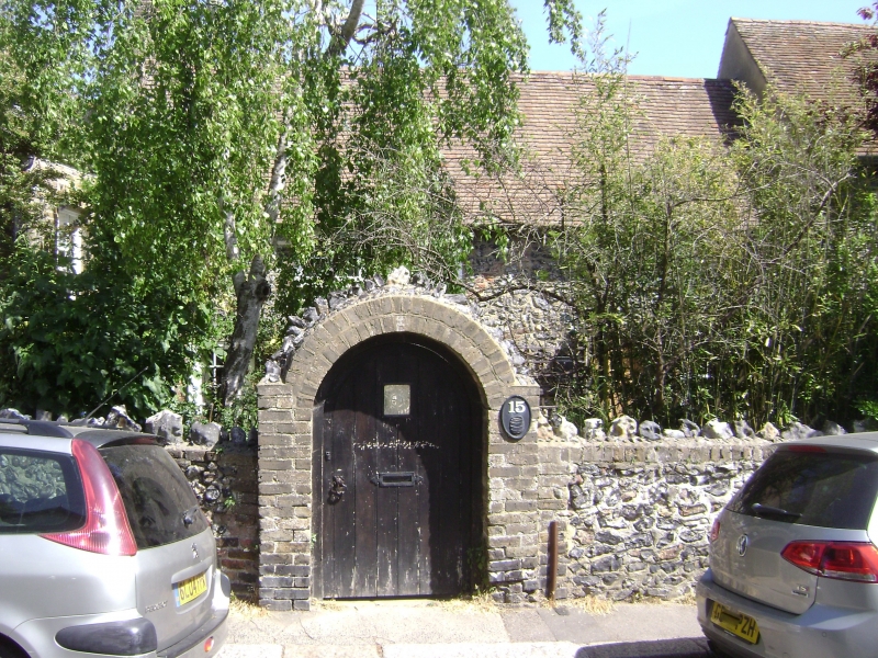
READING STREET
1.
5281
(North East Side)
BROADSTAIRS
No 15
TR 36 NE 5/155
II GV
2.
C18. 2 storeys flint-faced. Renewed tiled roof. 4 renewed casements on 1st floor.
4 sashes with glazing bars intact on ground floor and simple doorcase.
Nos 11 to 15 (odd) and The Corner Cottage form a group.
Listing NGR: TR3882869538
External links are from the relevant listing authority and, where applicable, Wikidata. Wikidata IDs may be related buildings as well as this specific building. If you want to add or update a link, you will need to do so by editing the Wikidata entry.


Other nearby listed buildings
