Latitude: 50.767 / 50°46'1"N
Longitude: -1.3058 / 1°18'20"W
OS Eastings: 449050
OS Northings: 96608
OS Grid: SZ490966
Mapcode National: GBR 89K.SST
Mapcode Global: FRA 8741.YYL
Plus Code: 9C2WQM8V+QM
Entry Name: Drinking Fountain
Listing Date: 9 August 1979
Grade: II
Source: Historic England
Source ID: 1267596
English Heritage Legacy ID: 418313
ID on this website: 101267596
Location: Prince's Green, Cowes, Isle of Wight, PO31
County: Isle of Wight
Civil Parish: Cowes
Built-Up Area: Cowes
Traditional County: Hampshire
Lieutenancy Area (Ceremonial County): Isle of Wight
Church of England Parish: West Cowes Holy Trinity
Church of England Diocese: Portsmouth
Tagged with: Drinking fountain
THE ESPLANADE
1.
5270
West Cowes
Princes Green
Drinking Fountain
SZ 49 NE 4/43
II
2.
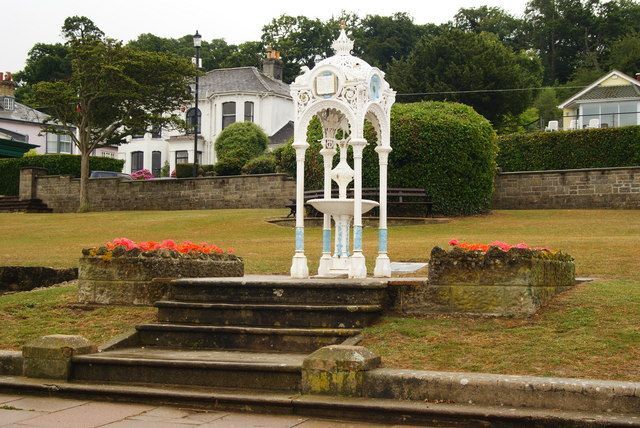
Circa 1890. Cast iron drinking fountain supported on 4 pillars with a domed
and fretted canopy.
Listing NGR: SZ4905096608
External links are from the relevant listing authority and, where applicable, Wikidata. Wikidata IDs may be related buildings as well as this specific building. If you want to add or update a link, you will need to do so by editing the Wikidata entry.


Other nearby listed buildings