Latitude: 54.1978 / 54°11'52"N
Longitude: -3.0979 / 3°5'52"W
OS Eastings: 328471
OS Northings: 478561
OS Grid: SD284785
Mapcode National: GBR 6MTW.3Z
Mapcode Global: WH725.DR18
Plus Code: 9C6R5WX2+4R
Entry Name: 38, the Gill
Listing Date: 20 June 1972
Last Amended: 19 April 1996
Grade: II
Source: Historic England
Source ID: 1270134
English Heritage Legacy ID: 460045
ID on this website: 101270134
Location: Ulverston, Westmorland and Furness, Cumbria, LA12
County: Westmorland and Furness
District: South Lakeland
Civil Parish: Ulverston
Built-Up Area: Ulverston
Traditional County: Lancashire
Lieutenancy Area (Ceremonial County): Cumbria
Church of England Parish: Ulverston St Mary with Holy Trinity
Church of England Diocese: Carlisle
Tagged with: Building
ULVERSTON
SD2878 THE GILL 626-1/3/141 (North side) 20/06/72 No.38 (Formerly Listed as: THE GILL Nos.36, 38, 38A AND 39)
GV II
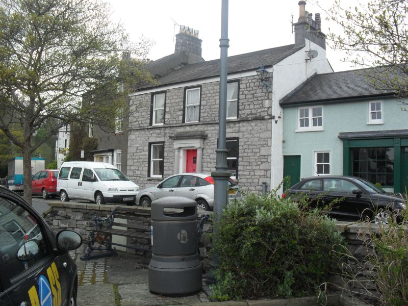
House. Early to mid C19. Limestone rubble (probably with roughcast removed) with limestone ashlar dressings and a slate roof. A symmetrical composition of 2 storeys above a cellar and 3 bays. The windows have narrow painted stone surrounds with projecting sills and with a 1st-floor sill band. They are sashed without glazing bars. Below the ground-floor windows are cellar openings. The door has a painted plain stone surround and a doorcase of limestone ashlar with engaged unfluted Greek Doric columns on square bases, a plain entablature with a fillet, a cornice and a blocking course. Chimneys to left and right. The right-hand chimney has a limestone ashlar cap.
Listing NGR: SD2847178561
External links are from the relevant listing authority and, where applicable, Wikidata. Wikidata IDs may be related buildings as well as this specific building. If you want to add or update a link, you will need to do so by editing the Wikidata entry.


Other nearby listed buildings