Latitude: 53.393 / 53°23'34"N
Longitude: -1.5164 / 1°30'58"W
OS Eastings: 432258
OS Northings: 388567
OS Grid: SK322885
Mapcode National: GBR 95F.CJ
Mapcode Global: WHCCB.PZ38
Plus Code: 9C5W9FVM+5C
Entry Name: Hollins Bridge
Listing Date: 12 December 1995
Grade: II
Source: Historic England
Source ID: 1270444
English Heritage Legacy ID: 458809
ID on this website: 101270444
Location: Woodland View, Sheffield, South Yorkshire, S6
County: Sheffield
Electoral Ward/Division: Walkley
Parish: Non Civil Parish
Traditional County: Yorkshire
Lieutenancy Area (Ceremonial County): South Yorkshire
Church of England Parish: Malin Bridge St Polycarp
Church of England Diocese: Sheffield
Tagged with: Bridge
SHEFFIELD
SK38NW HOLLINS LANE
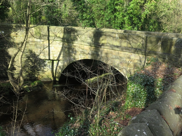
784-1/5/432 Hollins Bridge
II
Road bridge spanning the River Rivelin. Early C19. Coursed
squared stone with ashlar dressings. Single round arch with
keystone and string course. Splayed parapet walls with
chamfered tops.
Listing NGR: SK3225888567
External links are from the relevant listing authority and, where applicable, Wikidata. Wikidata IDs may be related buildings as well as this specific building. If you want to add or update a link, you will need to do so by editing the Wikidata entry.


Other nearby listed buildings