Latitude: 52.7079 / 52°42'28"N
Longitude: -2.7528 / 2°45'10"W
OS Eastings: 349232
OS Northings: 312511
OS Grid: SJ492125
Mapcode National: GBR BJ.2GZ3
Mapcode Global: WH8BT.P6BD
Plus Code: 9C4VP65W+5V
Entry Name: 8-15, St Alkmond's Place
Listing Date: 10 January 1953
Grade: II*
Source: Historic England
Source ID: 1270615
English Heritage Legacy ID: 457916
ID on this website: 101270615
Location: Shrewsbury, Shropshire, SY1
County: Shropshire
Civil Parish: Shrewsbury
Built-Up Area: Shrewsbury
Traditional County: Shropshire
Lieutenancy Area (Ceremonial County): Shropshire
Church of England Parish: Shrewsbury St Alkmund
Church of England Diocese: Lichfield
Tagged with: Building
SHREWSBURY
SJ4912NW ST ALKMOND'S PLACE 653-1/11/521 (South West side) 10/01/53 Nos.8-15 (Consecutive)
GV II*
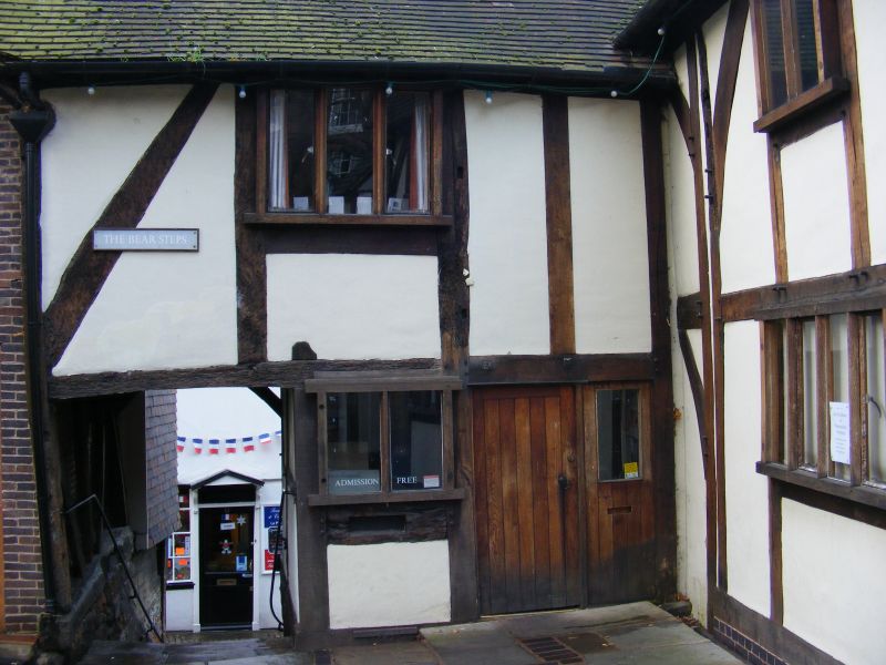
Row of former cottages, now extensively restored and in commercial use, and possibly originally built to include shops. Largely C16, but built around a C15 hall. Timber-framed with Welsh slate roof. Open hall forms wing to west: 3 bays of massive square-panelled timber-frame, each with arched bracing forming arcade. Small gallery recessed in rear gable to Fish Street. Main C16 range spans steps linking Fish Street and St Alkmond's Place: 3 storeys to Fish Street, 2 storeys to St Almond's Place. Timber-framed with close studding and middle rail, with some raking braces. Gallery to ground floor beneath very deep overhang of upper storey - an original feature extensively restored and possibly forming shop booths originally. Panel infill in wall behind this gallery largely replaced with glass. Irregular renewed fenestration on first floor. 2 tall gabled dormers in roof.
Listing NGR: SJ4923212511
External links are from the relevant listing authority and, where applicable, Wikidata. Wikidata IDs may be related buildings as well as this specific building. If you want to add or update a link, you will need to do so by editing the Wikidata entry.


Other nearby listed buildings