Latitude: 53.3132 / 53°18'47"N
Longitude: -1.5395 / 1°32'22"W
OS Eastings: 430780
OS Northings: 379680
OS Grid: SK307796
Mapcode National: GBR KZP4.H1
Mapcode Global: WHCCQ.BZ5F
Plus Code: 9C5W8F76+76
Entry Name: Steps and flanking walls 5 metres north west of Church of All Saints
Listing Date: 12 December 1995
Grade: II
Source: Historic England
Source ID: 1270874
English Heritage Legacy ID: 456918
ID on this website: 101270874
Location: Totley, Sheffield, South Yorkshire, S17
County: Sheffield
Electoral Ward/Division: Dore and Totley
Parish: Non Civil Parish
Built-Up Area: Sheffield
Traditional County: Derbyshire
Lieutenancy Area (Ceremonial County): South Yorkshire
Church of England Parish: Totley All Saints
Church of England Diocese: Sheffield
Tagged with: Architectural structure
This list entry was subject to a Minor Amendment on 4 November 2024 to amend the name and address and reformat the text to current standards.
SK37NW
784-1/12/890
SHEFFIELD
Totley
TOTLEY HALL LANE (east side (off))
Steps and flanking walls 5 metres north west of Church of All Saints
(Formerly listed as Steps and flanking walls 5m south-west of Church of All Saints)
GV
II
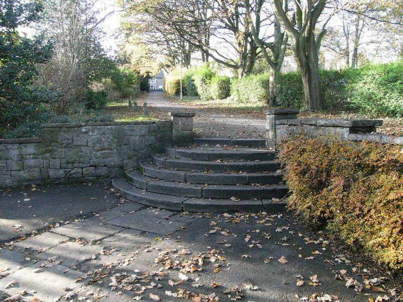
Steps and flanking walls. 1923. By Currie & Thompson of Derby. Random rubble and ashlar. Five semicircular ashlar steps with L-plan flanking walls with stepped flat copings. four square piers with flat caps. Included for group value.
Listing NGR: SK3078079680
External links are from the relevant listing authority and, where applicable, Wikidata. Wikidata IDs may be related buildings as well as this specific building. If you want to add or update a link, you will need to do so by editing the Wikidata entry.


Other nearby listed buildings