Latitude: 53.3772 / 53°22'37"N
Longitude: -1.4957 / 1°29'44"W
OS Eastings: 433647
OS Northings: 386824
OS Grid: SK336868
Mapcode National: GBR 99M.T5
Mapcode Global: WHDDP.0C1T
Plus Code: 9C5W9GG3+VP
Entry Name: St Marks Vicarage
Listing Date: 12 December 1995
Grade: II
Source: Historic England
Source ID: 1270945
English Heritage Legacy ID: 456471
ID on this website: 101270945
Location: Broomfield, Sheffield, South Yorkshire, S10
County: Sheffield
Electoral Ward/Division: Broomhill and Sharrow Vale
Parish: Non Civil Parish
Built-Up Area: Sheffield
Traditional County: Yorkshire
Lieutenancy Area (Ceremonial County): South Yorkshire
Church of England Parish: Sheffield Broomhill St Mark
Church of England Diocese: Sheffield
Tagged with: Clergy house
SHEFFIELD
SK3386NE ST MARK'S CRESCENT 784-1/27/685 (North West side) No.4 St Mark's Vicarage
GV II
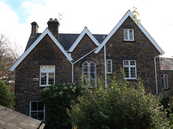
House, now vicarage. c1870. Coursed squared stone with ashlar dressings and slate roof with single gable and single side wall stacks. Plinth, moulded wooden eaves, fretted bargeboards to front gables. 2 storeys plus attics; 3 window range of wooden cross casements. Gabled wing to left has a single window and above, a single light window. Below, a canted stone bay window. In the right return angle, a lean-to porch with Tudor arched doorway and fretted bargeboard. To right, 2 window range with, below, a 3-light wooden cross casement. INTERIOR not inspected. Included for group value.
Listing NGR: SK3364786824
External links are from the relevant listing authority and, where applicable, Wikidata. Wikidata IDs may be related buildings as well as this specific building. If you want to add or update a link, you will need to do so by editing the Wikidata entry.


Other nearby listed buildings