Latitude: 51.8634 / 51°51'48"N
Longitude: -2.248 / 2°14'52"W
OS Eastings: 383019
OS Northings: 218345
OS Grid: SO830183
Mapcode National: GBR 1L5.2H0
Mapcode Global: VH94B.ZFFB
Plus Code: 9C3VVQ72+9R
Entry Name: 59, Southgate Street
Listing Date: 15 December 1998
Grade: II
Source: Historic England
Source ID: 1271764
English Heritage Legacy ID: 472480
ID on this website: 101271764
Location: Gloucester, Gloucestershire, GL1
County: Gloucestershire
District: Gloucester
Electoral Ward/Division: Westgate
Parish: Non Civil Parish
Built-Up Area: Gloucester
Traditional County: Gloucestershire
Lieutenancy Area (Ceremonial County): Gloucestershire
Church of England Parish: Hempsted with Gloucester, Saint Mary de Lode and Saint Mary de Crypt
Church of England Diocese: Gloucester
Tagged with: Building
GLOUCESTER
SO8318SW SOUTHGATE STREET 844-1/12/268 (East side) No.59
GV II
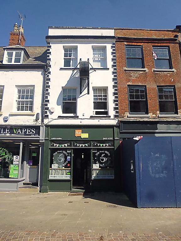
Cafe and dwelling. Mid C18, C19 and C20 alterations; rear damaged by fire, 1994. Brick stuccoed on front and painted white and stone dressings painted black, slate roof. Double-depth block. EXTERIOR: three storeys; on the front a C20 shop-front, raised and chamfered stone quoins at each end, and a moulded stone crowning cornice with parapet above. On each of the upper floors two sashes with glazing bars in the upper frames (3x2 panes), and projecting stone sills; centred between the first and second floors a C19 drum clock in a metal case supported by cast-iron brackets. INTERIOR: not inspected. Principally included for the facade's contribution towards this group of C18 properties which stand prominently at the south end of Southgate Street.
Listing NGR: SO8301918345
External links are from the relevant listing authority and, where applicable, Wikidata. Wikidata IDs may be related buildings as well as this specific building. If you want to add or update a link, you will need to do so by editing the Wikidata entry.


Other nearby listed buildings