Latitude: 50.7921 / 50°47'31"N
Longitude: -1.0912 / 1°5'28"W
OS Eastings: 464148
OS Northings: 99559
OS Grid: SZ641995
Mapcode National: GBR VR0.DX
Mapcode Global: FRA 87L0.4NZ
Plus Code: 9C2WQWR5+RG
Entry Name: 72, 74 and 76, King Street
Listing Date: 18 March 1999
Grade: II
Source: Historic England
Source ID: 1271866
English Heritage Legacy ID: 474835
ID on this website: 101271866
Location: Somers Town, Portsmouth, Hampshire, PO5
County: City of Portsmouth
Electoral Ward/Division: St Thomas
Parish: Non Civil Parish
Built-Up Area: Portsmouth
Traditional County: Hampshire
Lieutenancy Area (Ceremonial County): Hampshire
Church of England Parish: Southsea St Luke and St Peter
Church of England Diocese: Portsmouth
Tagged with: Building
PORTSMOUTH
SZ6499NW KING STREET, Southsea 774-1/22/380 (South side) Nos.72, 74 AND 76
GV II
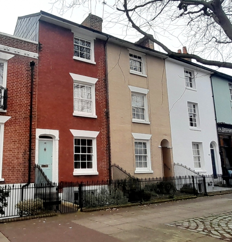
3 terraced houses. c1850. No.72 stuccoed, No.74 painted brickwork, No.76 red brick in Flemish bond. Interlocking tiled roof to Nos 72 and 76, Welsh slate to No.74. Nos 72 and 74 have rendered stack to right and brick stack to right of No.76. 3 storeys and basement, 3 bays. To left of No.76 2 steps approach a 4-recessed 4-panelled door, fanlight set under rendered basket arch with keystone, moulded imposts; Nos 72 and 74 each have on right a recessed 6-panelled door with fanlight, No.72 set under rendered round arch with imposts, and No.74 under painted brick round arch, no imposts. To right of No.76 and to left of Nos 72 and 74 is a 12-pane sash set under flat rendered arch; similar first floor windows over each and 9-pane sashes to second floors. C20 restored attached railings to fronts. INTERIOR not inspected.
Listing NGR: SZ6414399559
External links are from the relevant listing authority and, where applicable, Wikidata. Wikidata IDs may be related buildings as well as this specific building. If you want to add or update a link, you will need to do so by editing the Wikidata entry.


Other nearby listed buildings