Approximate Location Map
Large Map »
Latitude: 54.5122 / 54°30'43"N
Longitude: -2.9242 / 2°55'27"W
OS Eastings: 340258
OS Northings: 513376
OS Grid: NY402133
Mapcode National: GBR 8J08.P9
Mapcode Global: WH81V.1VS8
Plus Code: 9C6VG36G+V8
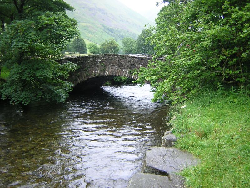
Entry Name: Cow Bridge
Listing Date: 15 March 1974
Grade: II
Source: Historic England
Source ID: 1271942
English Heritage Legacy ID: 452390
ID on this website: 101271942
Location: Hartsop, Westmorland and Furness, Cumbria, CA11
County: Cumbria
District: Eden
Civil Parish: Patterdale
Traditional County: Westmorland
Lieutenancy Area (Ceremonial County): Cumbria
Church of England Parish: Patterdale St Patrick
Church of England Diocese: Carlisle
Tagged with: Bridge
1.
1291A PATTERDALE
LOW HARTSOP
Cow Bridge
NY 41 SW 15/151
II
2.
C17 packhorse bridge, now widened.
Listing NGR: NY4025813376
External links are from the relevant listing authority and, where applicable, Wikidata. Wikidata IDs may be related buildings as well as this specific building. If you want to add or update a link, you will need to do so by editing the Wikidata entry.


Other nearby listed buildings
