Approximate Location Map
Large Map »
Latitude: 54.4337 / 54°26'1"N
Longitude: -3.0381 / 3°2'17"W
OS Eastings: 332756
OS Northings: 504754
OS Grid: NY327047
Mapcode National: GBR 7K75.1D
Mapcode Global: WH825.9TJD
Plus Code: 9C6RCXM6+FP
Entry Name: Elterwater Bridge
Listing Date: 12 January 1967
Grade: II
Source: Historic England
Source ID: 1271955
English Heritage Legacy ID: 452270
ID on this website: 101271955
Location: Elterwater, Westmorland and Furness, Cumbria, LA22
County: Cumbria
District: South Lakeland
Civil Parish: Lakes
Traditional County: Westmorland
Lieutenancy Area (Ceremonial County): Cumbria
Church of England Parish: Langdale Holy Trinity
Church of England Diocese: Carlisle
Tagged with: Road bridge Stone arch bridge
1.
1291A LANGDALES
ELTERWATER
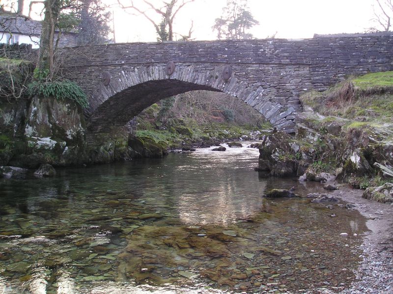
Elterwater Bridge
NY 30 SW 8/102 12.1.67. Bridge
II GV
2.
Rebuilt 1702, and widened later. Single segmental arch of stone rubble,
with level parapet, over Langdale Beck.
For group notes see General group description under Elterwater.
Listing NGR: NY3275604754
External links are from the relevant listing authority and, where applicable, Wikidata. Wikidata IDs may be related buildings as well as this specific building. If you want to add or update a link, you will need to do so by editing the Wikidata entry.


Other nearby listed buildings
