Approximate Location Map
Large Map »
Latitude: 51.3028 / 51°18'10"N
Longitude: -0.9713 / 0°58'16"W
OS Eastings: 471808
OS Northings: 156468
OS Grid: SU718564
Mapcode National: GBR C7L.781
Mapcode Global: VHDXL.3JV3
Plus Code: 9C3X823H+4F
Entry Name: Baronmead
Listing Date: 26 June 1987
Grade: II
Source: Historic England
Source ID: 1272317
English Heritage Legacy ID: 449686
ID on this website: 101272317
Location: Rotherwick, Hart, Hampshire, RG27
County: Hampshire
District: Hart
Civil Parish: Rotherwick
Built-Up Area: Rotherwick
Traditional County: Hampshire
Lieutenancy Area (Ceremonial County): Hampshire
Church of England Parish: Heckfield with Mattingley and Rotherwick
Church of England Diocese: Winchester
Tagged with: Building
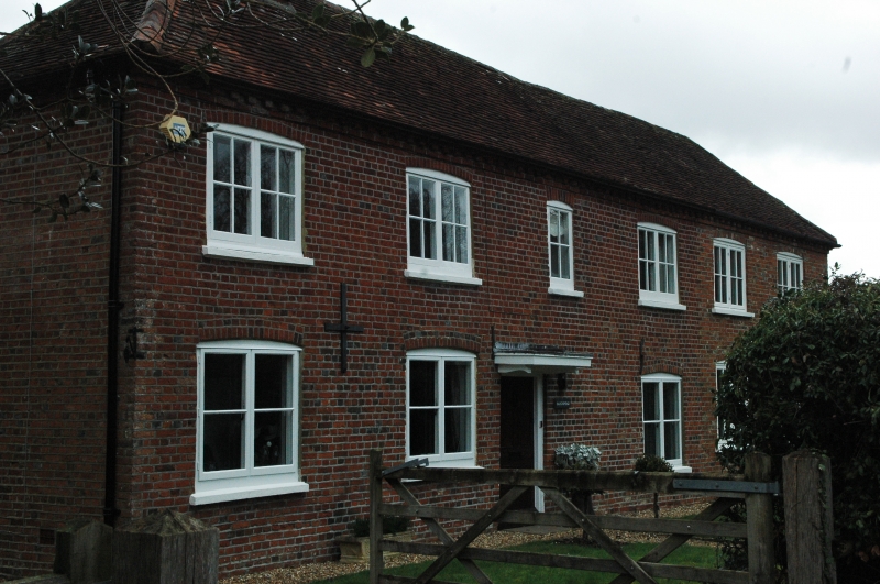
SU 75 NW ROTHERWICK THE STREET
(north side)
4/86
- Baronmead
- II
Early C19. 2 storeys, 3 windows. Red tile hipped roof, brick dentil eaves.
Red brick walling in English bond, with cambered ground-floor openings.
Casements. Doorway has a solid frame.
Listing NGR: SU7180856468
External links are from the relevant listing authority and, where applicable, Wikidata. Wikidata IDs may be related buildings as well as this specific building. If you want to add or update a link, you will need to do so by editing the Wikidata entry.


Other nearby listed buildings
