Latitude: 51.0862 / 51°5'10"N
Longitude: -0.7078 / 0°42'28"W
OS Eastings: 490600
OS Northings: 132669
OS Grid: SU906326
Mapcode National: GBR DCS.V5G
Mapcode Global: FRA 96D7.XQW
Plus Code: 9C3X37PR+FV
Entry Name: Industrial Building to West of No 31
Listing Date: 3 December 1953
Grade: II
Source: Historic England
Source ID: 1272374
English Heritage Legacy ID: 449447
ID on this website: 101272374
Location: Shepherd's Hill, Waverley, Surrey, GU27
County: Surrey
District: Waverley
Civil Parish: Haslemere
Built-Up Area: Haslemere
Traditional County: Surrey
Lieutenancy Area (Ceremonial County): Surrey
Church of England Parish: Haslemere
Church of England Diocese: Guildford
Tagged with: Architectural structure
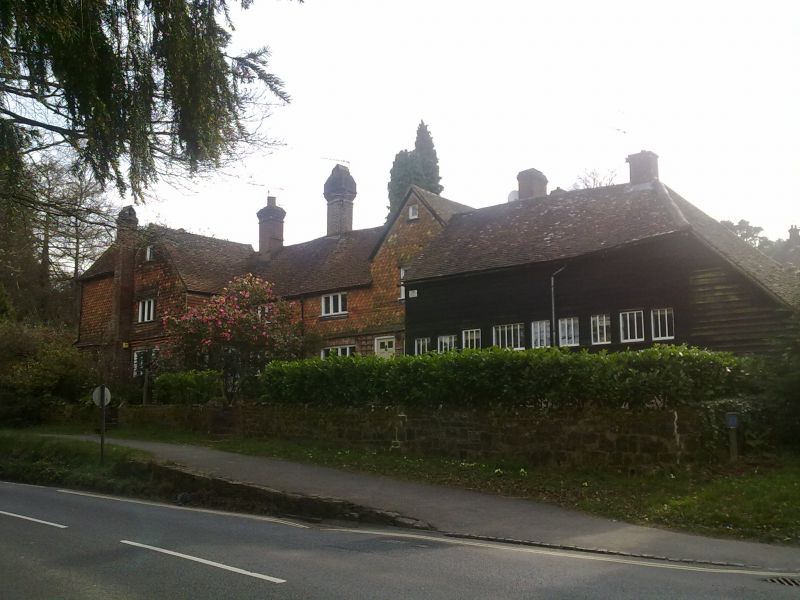
PETWORTH ROAD 1. 5393 (South-West Side) 3.12.53. Nos 31, 33 and 35 - with Industrial Building to west of No 31 SU 9032 NE 4/152 II GV 2. C17 with alterations. Long and very irregular timber framed range. Central section of 2 storeys, 2 bays, with tiny attic window high in gable over right bay. Tile hung first floor banded fishscale and plain; brick ground floor on rubble foundation. Plain casements. Top glazed 6-panel door. Right section is the industrial building, a weather-boarded barn with hipped tiled roof and later lean-to extension. Left section has some exposed square framing with brick filling on ground floor, tile hanging above. Two bays, the left bay projecting and gabled, with small coursed rubble below and fishscale tiles above. Modern but seemly leaded casements. Top glazed 6-panel door in angle. Brick dentil cornice below tiles. Added left bay of similar materials.
Listing NGR: SU9060032669
External links are from the relevant listing authority and, where applicable, Wikidata. Wikidata IDs may be related buildings as well as this specific building. If you want to add or update a link, you will need to do so by editing the Wikidata entry.


Other nearby listed buildings