Latitude: 51.253 / 51°15'10"N
Longitude: -0.9412 / 0°56'28"W
OS Eastings: 473991
OS Northings: 150957
OS Grid: SU739509
Mapcode National: GBR C86.8WC
Mapcode Global: VHDXS.MRTT
Plus Code: 9C3X7335+5G
Entry Name: Bury House
Listing Date: 8 July 1952
Grade: II
Source: Historic England
Source ID: 1272756
English Heritage Legacy ID: 136915
ID on this website: 101272756
Location: Odiham, Hart, Hampshire, RG29
County: Hampshire
District: Hart
Civil Parish: Odiham
Built-Up Area: Odiham
Traditional County: Hampshire
Lieutenancy Area (Ceremonial County): Hampshire
Church of England Parish: Odiham All Saints
Church of England Diocese: Winchester
Tagged with: House
SU 73-7450 & 73-7451 ODIHAM THE BURY
17/101 Bury House
8.7.52 - II
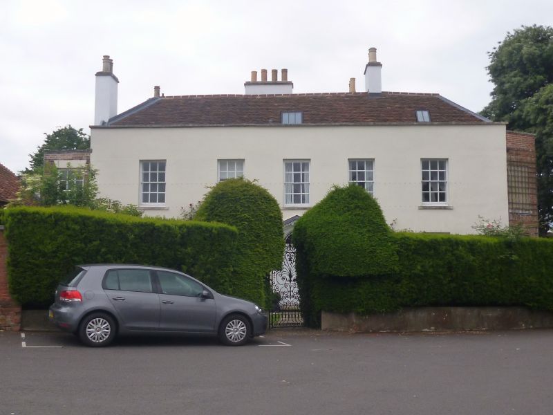
C18. 2 storeys and attic, symmetrical (east) front of 5 windows, with short set-back wing to south, of 1 window. Red tile roof, hipped. Rendered walling, stone coping to parapet, plain openings, plinth. Sashes in reveals. Doorcase has open pediment on triple brackets, enclosing an arched doorway, with broken entablature above Doric 1/2-columns (fluted), fanlight, 6-panelled door. North end in red brickwork, with symmetrical facade of 2 two-storeyed angular bays, some of windows being filled, others having sashes. Rear (west) elevation of 4 dormers above 7 windows. To the south of the house is a stable block (C18, extended C19) of 1-storey and attic, red tile roof, 4 gabled dormers, red brick walling. There is a low front boundary wall with iron rails and a central wrought-iron gate, continuing to the north as a high red brick wall, with buttresses.
Listing NGR: SU7399150950
External links are from the relevant listing authority and, where applicable, Wikidata. Wikidata IDs may be related buildings as well as this specific building. If you want to add or update a link, you will need to do so by editing the Wikidata entry.


Other nearby listed buildings