Approximate Location Map
Large Map »
Latitude: 51.247 / 51°14'49"N
Longitude: 0.2422 / 0°14'32"E
OS Eastings: 556592
OS Northings: 152143
OS Grid: TQ565521
Mapcode National: GBR MND.N35
Mapcode Global: VHHPT.4XXG
Plus Code: 9F3266WR+QV
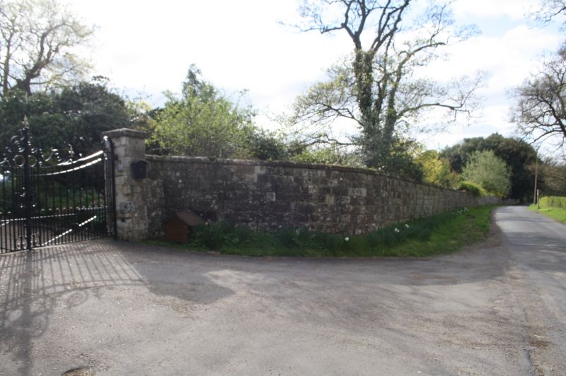
Entry Name: Front Boundary Wall to Grounds of Under River House
Listing Date: 16 January 1975
Grade: II
Source: Historic England
Source ID: 1272854
English Heritage Legacy ID: 447434
ID on this website: 101272854
Location: Underriver, Sevenoaks, Kent, TN15
County: Kent
District: Sevenoaks
Civil Parish: Seal
Traditional County: Kent
Lieutenancy Area (Ceremonial County): Kent
Church of England Parish: Underriver St Margaret
Church of England Diocese: Rochester
Tagged with: Wall
1.
5280 SEAL UNDERRIVER
Front boundary wall to
grounds of Under River House
TQ 55 SE 47/1083
II
2.
Long C18 wall of galletted rubble masonry.
Listing NGR: TQ5565351916
External links are from the relevant listing authority and, where applicable, Wikidata. Wikidata IDs may be related buildings as well as this specific building. If you want to add or update a link, you will need to do so by editing the Wikidata entry.


Other nearby listed buildings
