Approximate Location Map
Large Map »
Latitude: 52.725 / 52°43'29"N
Longitude: -2.2436 / 2°14'37"W
OS Eastings: 383643
OS Northings: 314177
OS Grid: SJ836141
Mapcode National: GBR 17Q.3LD
Mapcode Global: WHBF4.HRTT
Plus Code: 9C4VPQF4+XH
Entry Name: Elm Tree Farmhouse
Listing Date: 5 November 1979
Grade: II
Source: Historic England
Source ID: 1273404
English Heritage Legacy ID: 445187
ID on this website: 101273404
Location: Marston, Stafford, Staffordshire, ST20
County: Staffordshire
District: Stafford
Civil Parish: Church Eaton
Traditional County: Staffordshire
Lieutenancy Area (Ceremonial County): Staffordshire
Church of England Parish: Church Eaton St Editha
Church of England Diocese: Lichfield
Tagged with: Farmhouse
SJ 81 SW
10/16
CHURCH EATON
Marston
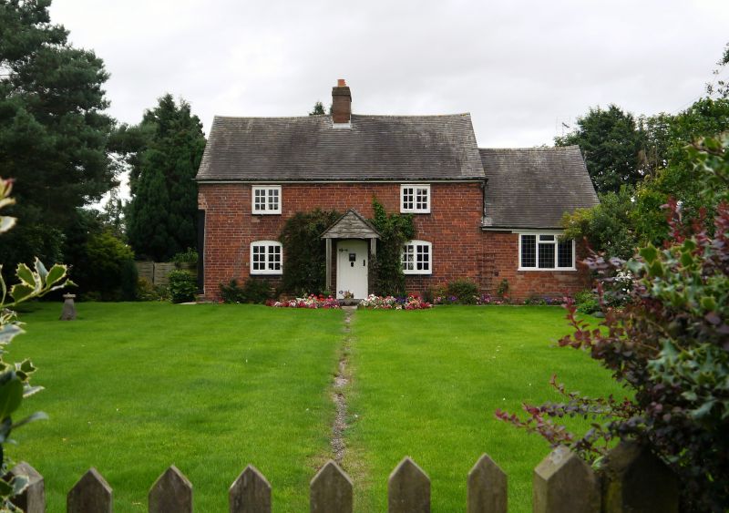
Elm Tree Farmhouse
II
2.
C17 and later. Timber framed and brick. Brick front of later date; casement
windows; 2 window front; good exposed timber gable at North end; tiled
roof; brick stacks; modern single storey addition at South end.
Listing NGR: SJ8364314177
External links are from the relevant listing authority and, where applicable, Wikidata. Wikidata IDs may be related buildings as well as this specific building. If you want to add or update a link, you will need to do so by editing the Wikidata entry.


Other nearby listed buildings
