Approximate Location Map
Large Map »
Latitude: 51.0699 / 51°4'11"N
Longitude: -0.5075 / 0°30'27"W
OS Eastings: 504664
OS Northings: 131126
OS Grid: TQ046311
Mapcode National: GBR GGW.Y85
Mapcode Global: FRA 96T9.B2B
Plus Code: 9C3X3F9R+XX
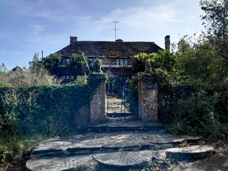
Entry Name: Brewhurst Farmhouse
Listing Date: 22 February 1955
Grade: II
Source: Historic England
Source ID: 1273578
English Heritage Legacy ID: 417718
ID on this website: 101273578
Location: Loxwood, Chichester, West Sussex, RH14
County: West Sussex
District: Chichester
Civil Parish: Loxwood
Traditional County: Sussex
Lieutenancy Area (Ceremonial County): West Sussex
Church of England Parish: Alfold and Loxwood
Church of England Diocese: Guildford
Tagged with: Farmhouse
TQ 03 SW LOXWOOD BREWHURST LANE
3/645 Brewhurst Farmhouse
22.2.55
II
Farmhouse. L-shaped C17 or earlier timber-framed building with painted brick
infilling, the first floor hung with fishscale tiles. Hipped roof or Horsham slabs.
Casement windows, some with wooden mullions and transome. Gabled porch. Two storeys.
Four windows.
Listing NGR: TQ0466431126
External links are from the relevant listing authority and, where applicable, Wikidata. Wikidata IDs may be related buildings as well as this specific building. If you want to add or update a link, you will need to do so by editing the Wikidata entry.


Other nearby listed buildings
