Latitude: 50.6835 / 50°41'0"N
Longitude: -3.4652 / 3°27'54"W
OS Eastings: 296584
OS Northings: 88116
OS Grid: SX965881
Mapcode National: GBR P2.JRNV
Mapcode Global: FRA 37M8.HV3
Plus Code: 9C2RMGMM+9W
Entry Name: 2 and 4, Majorfield Road
Listing Date: 18 June 1974
Grade: II
Source: Historic England
Source ID: 1273655
English Heritage Legacy ID: 417496
ID on this website: 101273655
Location: Topsham, Exeter, Devon, EX3
County: Devon
District: Exeter
Electoral Ward/Division: Topsham
Parish: Non Civil Parish
Built-Up Area: Topsham
Traditional County: Devon
Lieutenancy Area (Ceremonial County): Devon
Church of England Parish: Topsham St Margaret
Church of England Diocese: Exeter
Tagged with: Building
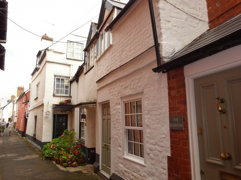
MAJORFIELD ROAD 1. 1092 (South Side) TOPSHAM Nos 2 and 4 SX 9687 8/1032 II 2. 2 storey and 3 storey. C17 colour-washed brick cottages behind Fore Street Post Office. Half-dormers. Door-hoods on brackets. Sash windows and casements, some of the latter with leaded lights and hand made glass. Varied roof line with No 4 higher and with a projecting brick string. Slate roof.
Listing NGR: SX9658388113
External links are from the relevant listing authority and, where applicable, Wikidata. Wikidata IDs may be related buildings as well as this specific building. If you want to add or update a link, you will need to do so by editing the Wikidata entry.


Other nearby listed buildings