Approximate Location Map
Large Map »
Latitude: 51.4053 / 51°24'19"N
Longitude: 0.2464 / 0°14'47"E
OS Eastings: 556346
OS Northings: 169758
OS Grid: TQ563697
Mapcode National: GBR WF.6S9
Mapcode Global: VHHP1.7Y42
Plus Code: 9F32C64W+4H
Entry Name: Paddock Cottage
Listing Date: 22 October 1982
Grade: II
Source: Historic England
Source ID: 1273914
English Heritage Legacy ID: 416423
ID on this website: 101273914
Location: South Darenth, Sevenoaks, Kent, DA4
County: Kent
District: Sevenoaks
Civil Parish: Horton Kirby and South Darenth
Built-Up Area: South Darenth
Traditional County: Kent
Lieutenancy Area (Ceremonial County): Kent
Church of England Parish: Horton Kirby St Mary
Church of England Diocese: Rochester
Tagged with: Cottage
1. HORTON KIRBY HOLMESDALE ROAD
5280
South Darenth
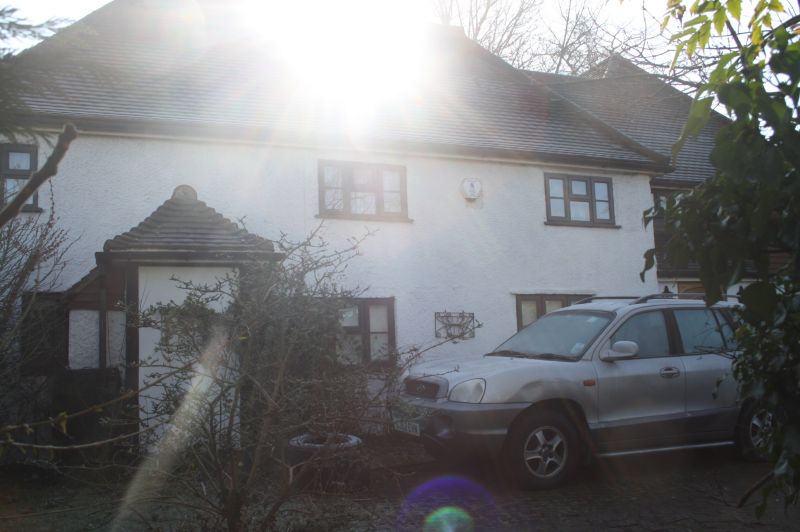
Paddock Cottage
TQ 56 NE 3/186
II
2.
C17 or earlier timber-framed building much restored. Two storeys faced with
roughcast. Hipped roof now covered in modern pantiles. Three modern casement
windows. Modern porch with hipped tiled hood. Interior has inglenook fireplace.
Listing NGR: TQ5634669758
External links are from the relevant listing authority and, where applicable, Wikidata. Wikidata IDs may be related buildings as well as this specific building. If you want to add or update a link, you will need to do so by editing the Wikidata entry.


Other nearby listed buildings
