Latitude: 51.2737 / 51°16'25"N
Longitude: 0.5352 / 0°32'6"E
OS Eastings: 576937
OS Northings: 155778
OS Grid: TQ769557
Mapcode National: GBR PR7.44V
Mapcode Global: VHJMF.77BY
Plus Code: 9F327GFP+F3
Entry Name: 35, Ashford Road
Listing Date: 2 August 1974
Grade: II
Source: Historic England
Source ID: 1273958
English Heritage Legacy ID: 173235
ID on this website: 101273958
Location: Maidstone, Kent, ME14
County: Kent
District: Maidstone
Electoral Ward/Division: High Street
Parish: Non Civil Parish
Built-Up Area: Maidstone
Traditional County: Kent
Lieutenancy Area (Ceremonial County): Kent
Tagged with: Building
ASHFORD ROAD 1. 5278 (North Side) No 35 TQ 7655 NE 3/89 II GV
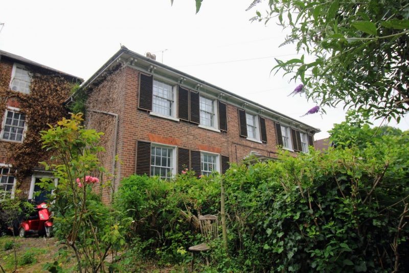
2. Circa 1830. 2 storeys and basement red brick. Hipped slate roof. Bracket eaves cornice. 5 sashes with Venetian shutters and glazing bars intact. Porch up 4 steps with pairs of clustered wooden columns and tent-shaped canopy.
Nos 27 to 35 (odd) form a group.
Listing NGR: TQ7693755778
External links are from the relevant listing authority and, where applicable, Wikidata. Wikidata IDs may be related buildings as well as this specific building. If you want to add or update a link, you will need to do so by editing the Wikidata entry.


Other nearby listed buildings