Latitude: 51.3803 / 51°22'49"N
Longitude: 0.2223 / 0°13'20"E
OS Eastings: 554754
OS Northings: 166932
OS Grid: TQ547669
Mapcode National: GBR VM.SV0
Mapcode Global: VHHP6.SKXP
Plus Code: 9F3296JC+4W
Entry Name: Old Bakehouse and Cartshed
Listing Date: 22 October 1982
Grade: II
Source: Historic England
Source ID: 1274476
English Heritage Legacy ID: 415086
ID on this website: 101274476
Location: Farningham, Sevenoaks, Kent, DA4
County: Kent
District: Sevenoaks
Civil Parish: Farningham
Built-Up Area: Eynsford
Traditional County: Kent
Lieutenancy Area (Ceremonial County): Kent
Church of England Parish: Farningham St Peter and St Paul
Church of England Diocese: Rochester
Tagged with: Architectural structure
FARNINGHAM In the entry for
HIGH STREET (north-east side) 10/100 Old Bakehouse and Cart shed
In part 2 of the entry the last sentence should be amended to read" This is adjoining an C18 open cartshed with tiled roof and square wooden pillars". ----------------------------------------------------------
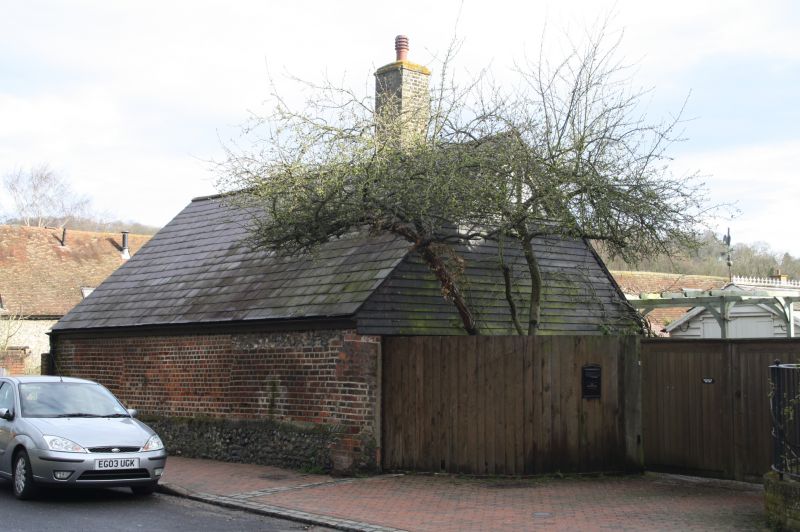
FARNINGHAM HIGH STREET 1. 5280 (north-east side) Old Bakehouse and Cartshed TQ 5466 10/100 II GV 2. Early C19. One storey stock brick with slate roof. On the elevation to the High Street it incorporates part of an C18 red brick and flint wall. Weatherboarded gable and large chimney to old bake oven. This is attached to an C18 open cart shed with tiled roof and squars wooden pillars.
Listing NGR: TQ5475366932
External links are from the relevant listing authority and, where applicable, Wikidata. Wikidata IDs may be related buildings as well as this specific building. If you want to add or update a link, you will need to do so by editing the Wikidata entry.


Other nearby listed buildings