Approximate Location Map
Large Map »
Latitude: 51.055 / 51°3'18"N
Longitude: 0.4103 / 0°24'37"E
OS Eastings: 569021
OS Northings: 131171
OS Grid: TQ690311
Mapcode National: GBR NS8.VYQ
Mapcode Global: FRA C6RB.FNV
Plus Code: 9F323C46+24
Entry Name: Walter's Farmhouse
Listing Date: 13 May 1987
Grade: II
Source: Historic England
Source ID: 1274514
English Heritage Legacy ID: 414894
ID on this website: 101274514
Location: Three Leg Cross, Rother, East Sussex, TN5
County: East Sussex
District: Rother
Civil Parish: Ticehurst
Traditional County: Sussex
Lieutenancy Area (Ceremonial County): East Sussex
Church of England Parish: Ticehurst St Mary
Church of England Diocese: Chichester
Tagged with: Farmhouse
TQ 63 SE TICEHURST TINKER'S LANE
1/24 Walter's Farmhouse
II
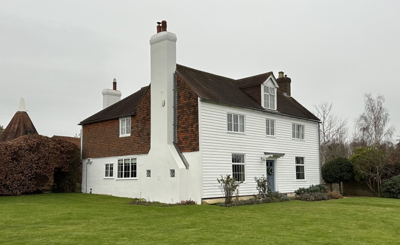
L-shaped C18 or earlier house. Two storeys and attic. Three windows. One
modern dormer. Faced with weather boarding. Tiled roof. Casement windows.
Doorway with flat hood on brackets. The south wall is tile-hung with a stuccoed
chimney breast.
Listing NGR: TQ6902131171
External links are from the relevant listing authority and, where applicable, Wikidata. Wikidata IDs may be related buildings as well as this specific building. If you want to add or update a link, you will need to do so by editing the Wikidata entry.


Other nearby listed buildings
