Approximate Location Map
Large Map »
Latitude: 50.9611 / 50°57'40"N
Longitude: 0.5228 / 0°31'21"E
OS Eastings: 577257
OS Northings: 120999
OS Grid: TQ772209
Mapcode National: GBR PVX.M0G
Mapcode Global: FRA C6ZK.PH7
Plus Code: 9F22XG6F+F4
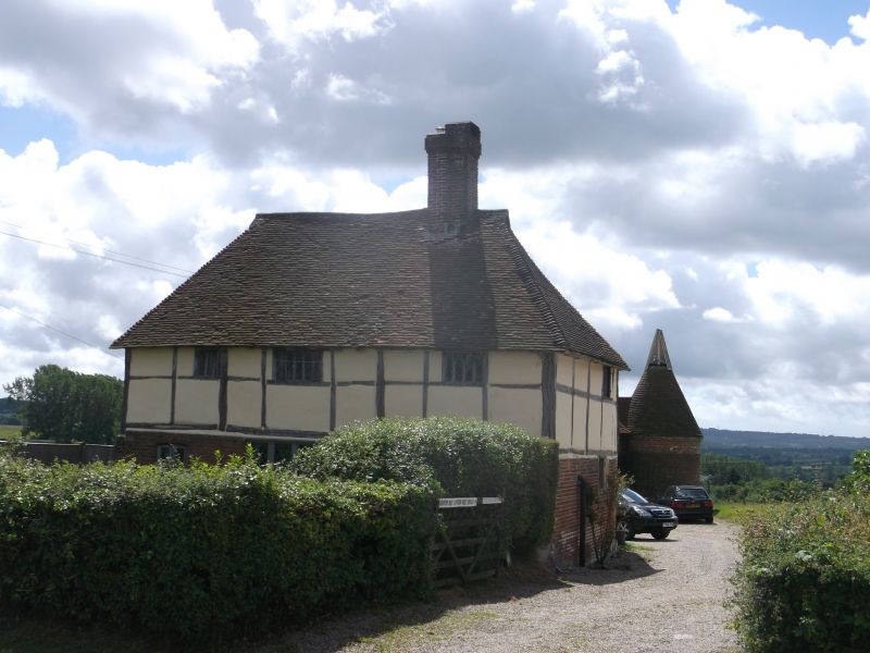
Entry Name: Little Swailes Green Farmhouse
Listing Date: 13 May 1987
Grade: II
Source: Historic England
Source ID: 1274778
English Heritage Legacy ID: 414170
ID on this website: 101274778
Location: Swaile's Green, Rother, East Sussex, TN32
County: East Sussex
District: Rother
Civil Parish: Sedlescombe
Traditional County: Sussex
Lieutenancy Area (Ceremonial County): East Sussex
Church of England Parish: Sedlescombe St John the Baptist
Church of England Diocese: Chichester
Tagged with: Farmhouse
TQ 72 SE
13/68
SEDLESCOMBE
SWAILE'S GREEN
Little Swailes Green Farmhouse
II
C17 or earlier. Two storeys. Two windows. Ground floor red brick, above weather-
boarded. Steeply-pitched hipped tiled roof. Casement windows. Gabled porch.
Listing NGR: TQ7725720999
External links are from the relevant listing authority and, where applicable, Wikidata. Wikidata IDs may be related buildings as well as this specific building. If you want to add or update a link, you will need to do so by editing the Wikidata entry.


Other nearby listed buildings
