Latitude: 51.5132 / 51°30'47"N
Longitude: -0.1251 / 0°7'30"W
OS Eastings: 530196
OS Northings: 181035
OS Grid: TQ301810
Mapcode National: GBR JC.2Q
Mapcode Global: VHGQZ.S768
Plus Code: 9C3XGV7F+7W
Entry Name: 6, Langley Street WC2
Listing Date: 15 January 1973
Grade: II
Source: Historic England
Source ID: 1274946
English Heritage Legacy ID: 413721
ID on this website: 101274946
Location: Strand, Westminster, London, WC2H
County: London
District: City of Westminster
Electoral Ward/Division: St James's
Parish: Non Civil Parish
Built-Up Area: City of Westminster
Traditional County: Middlesex
Lieutenancy Area (Ceremonial County): Greater London
Church of England Parish: St Paul Covent Garden
Church of England Diocese: London
Tagged with: Building
TQ 3081 SW CITY OF WESTMINSTER LANGLEY STREET, WC2 59/19 15.1.73 No 6
G.V. II
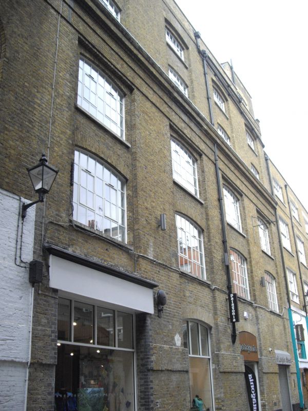
Warehouse. Early C19, originally part of brewery complex. Yellow stock brick, slate roof. 5 storeys. 4 windows wide. Ground floor altered later C20 with doorways and display windows. Upper floors have segmental gauged arch windows in through-storey recesses. Brick plat band to 1st floor and main brick cornice over 2nd floor; 2-storey attic with parapet coping. Rare survival of warehousing of this quality and date since demolition in Dockland.
Listing NGR: TQ3020281038
External links are from the relevant listing authority and, where applicable, Wikidata. Wikidata IDs may be related buildings as well as this specific building. If you want to add or update a link, you will need to do so by editing the Wikidata entry.


Other nearby listed buildings