Latitude: 50.7297 / 50°43'46"N
Longitude: -1.1587 / 1°9'31"W
OS Eastings: 459472
OS Northings: 92564
OS Grid: SZ594925
Mapcode National: GBR 9CN.1W8
Mapcode Global: FRA 87G4.VT9
Plus Code: 9C2WPRHR+VG
Entry Name: Wall and Gate Piers of No 15
Listing Date: 18 May 1972
Grade: II
Source: Historic England
Source ID: 1275099
English Heritage Legacy ID: 413389
ID on this website: 101275099
Location: Ryde, Isle of Wight, PO33
County: Isle of Wight
Civil Parish: Ryde
Built-Up Area: Ryde
Traditional County: Hampshire
Lieutenancy Area (Ceremonial County): Isle of Wight
Church of England Parish: Oakfield St John
Church of England Diocese: Portsmouth
Tagged with: Wall
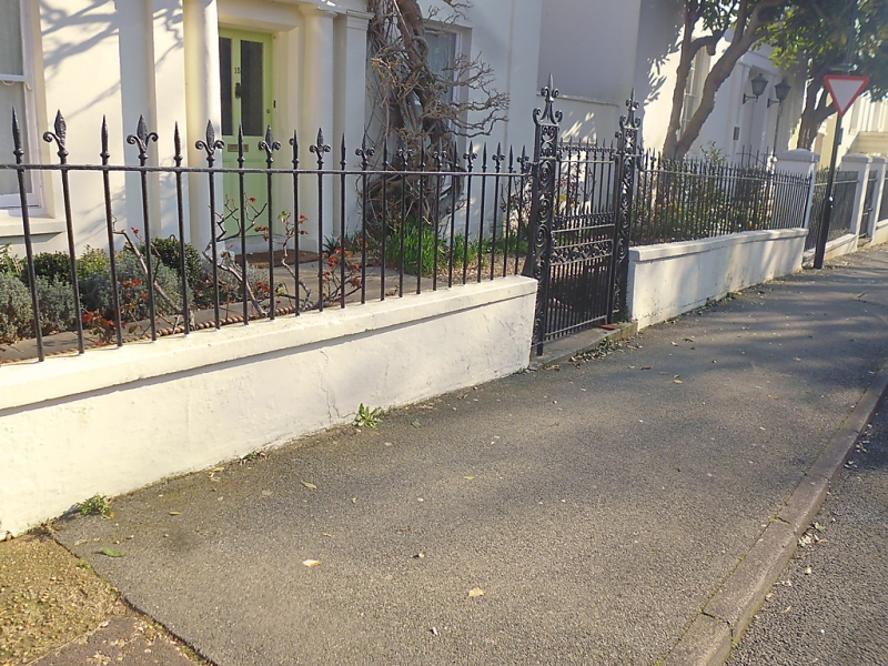
MELVILLE STREET 1. 1577 (North Side) Wall and gate piers of No 15 SZ 5992 2/255A
II
2. Low wall with railings consisting of alternate pointed and splayed spear heads. Gate piers of cast iron with scroll panels, surmounted by spear head supported by diagonal scrolls.
Listing NGR: SZ5947292564
External links are from the relevant listing authority and, where applicable, Wikidata. Wikidata IDs may be related buildings as well as this specific building. If you want to add or update a link, you will need to do so by editing the Wikidata entry.


Other nearby listed buildings